Naqsh-e Jahan: the 524-meter square of Shah Abbas's Isfahan

TL;DR — Shah Abbas laid out a 524-by-158-meter square at Isfahan from 1592 and began the Masjed-e Shah on it in 1611; deported Armenian merchants carried his silk.
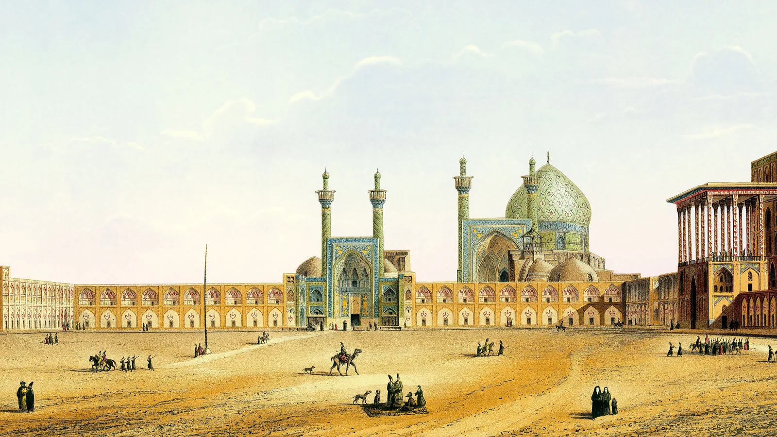
The Meydan-e Naqsh-e Jahan at Isfahan measures 524 by 158 meters, and the Masjed-e Shah at its southern end was begun in 1611. Shah Abbas I, who proclaimed Isfahan the seat of his government in the Islamic year that ran from 1597 into 1598, had the square outlined in 1592 and the Chahar Bagh avenue designed the year after. He filled its bazaar with a people he had uprooted. In the fall of 1604 he deported the Armenian merchants of Julfa, settled them across the Zayandeh Rud from his new center, and in 1619 made the export of raw silk a royal monopoly that they and the English East India Company competed to carry.
Quick facts
- When
- October 1588 (Abbas crowned at Qazvin, by Savory's dating) · 1592 to 1593 (square outlined) · 1597 to 1598 (Isfahan proclaimed seat of government) · October 21 to November 19, 1604 (Julfa deported) · 1611 (Masjed-e Shah begun) · 1619 (silk made a crown monopoly) · 1622 (Hormuz taken) · January 19, 1629 (Abbas died)
- Where
- Isfahan on the Zayandeh Rud in central Iran; Qazvin, the earlier seat; Julfa on the Aras river in what is now Azerbaijan; Hormuz at the mouth of the Persian Gulf
- Who
- Shah Abbas I; the gholam general Allahverdi Khan and his son Emamqoli Khan; the Sherley brothers; Pietro della Valle; the Armenian merchants of New Julfa; Jean Chardin
- Outcome
- A royal square of 524 by 158 meters with a mosque, a palace and a bazaar; an avenue up to 48 meters wide; an Armenian suburb whose merchants carried Iranian silk to Europe under a royal monopoly from 1619
A seventeen-year-old shah and a slave army
Abbas was crowned at Qazvin at seventeen. Roger Savory’s entry in the Encyclopaedia Iranica dates the ceremony to October 1, 1588; the encyclopedia’s entries on Isfahan and on Julfa give 1587. The Qezelbash chief who put him there, Morshed-qoli Khan Ostajlu, took the office of deputy of the court as his reward, and Abbas answered with a standing army of his own, the gholams: Georgian, Armenian and Circassian prisoners from the Caucasus, converted to Islam and trained in the royal household. Savory wrote that they were “analogous to the Ottoman qapi-qollari,” the sultan’s slave troops, and that their loyalty ran to the shah’s person, not to a tribe.
The wars came first. Uzbek armies held Herat in the east, and the Ottomans held Tabriz and the northwest. When the Uzbek ruler Abdollah Khan died in 1598, Abbas retook Herat that August after ten years in enemy hands. The Ottoman campaign opened in the fall of 1603 with Tabriz and Nakhichevan, took Erevan in June 1604, and after the victory at Sufian pushed the Ottomans back to the line of the 1555 treaty of Amasya. Peace was signed at Sarab in 1618.
Qazvin to Isfahan, a capital the shah rarely used
The court chroniclers Eskandar Beg and Molla Jalal both recorded that the royal household moved to Isfahan and that Abbas proclaimed the city his maqarr-e dowlat, seat of government, in 1006 of the Islamic calendar, 1597 to 1598. Masashi Haneda and Rudi Matthee, in their Iranica entry on Safavid Isfahan, wrote that most scholars take that year as the transfer of the capital. Stephen Blake, in Half the World (1999), read a mention of designs under 1588 as the real beginning; Sussan Babaie, reviewing the book in 2000, rejected that dating, and Haneda and Matthee sided with her.
They also warned against the word capital. Tabriz and Qazvin went on being called dar al-saltana, seat of the sultanate, and the court was wherever the ruler was. Abbas spent less than two months a year in Isfahan on average across his reign. Isfahan was where the buildings were, and after the transfer every coronation was held there.
Stone, water and plane trees: the square and the Chahar Bagh
The outline of the square and of the Qaysariya bazaar at its north end was begun in 1001 of the Islamic calendar, 1592 to 1593; the Chahar Bagh and the Sheikh Lotfollah mosque were designed the following year. By 1603 the shops, caravansaries, bathhouses and coffeehouses around the square were finished. The Masjed-e Shah at its southern end was begun in 1611 and was all but complete when Abbas died in 1629; Savory’s entry prints 1603 and 1611 beside one Islamic year for the two mosques, a slip in one line.
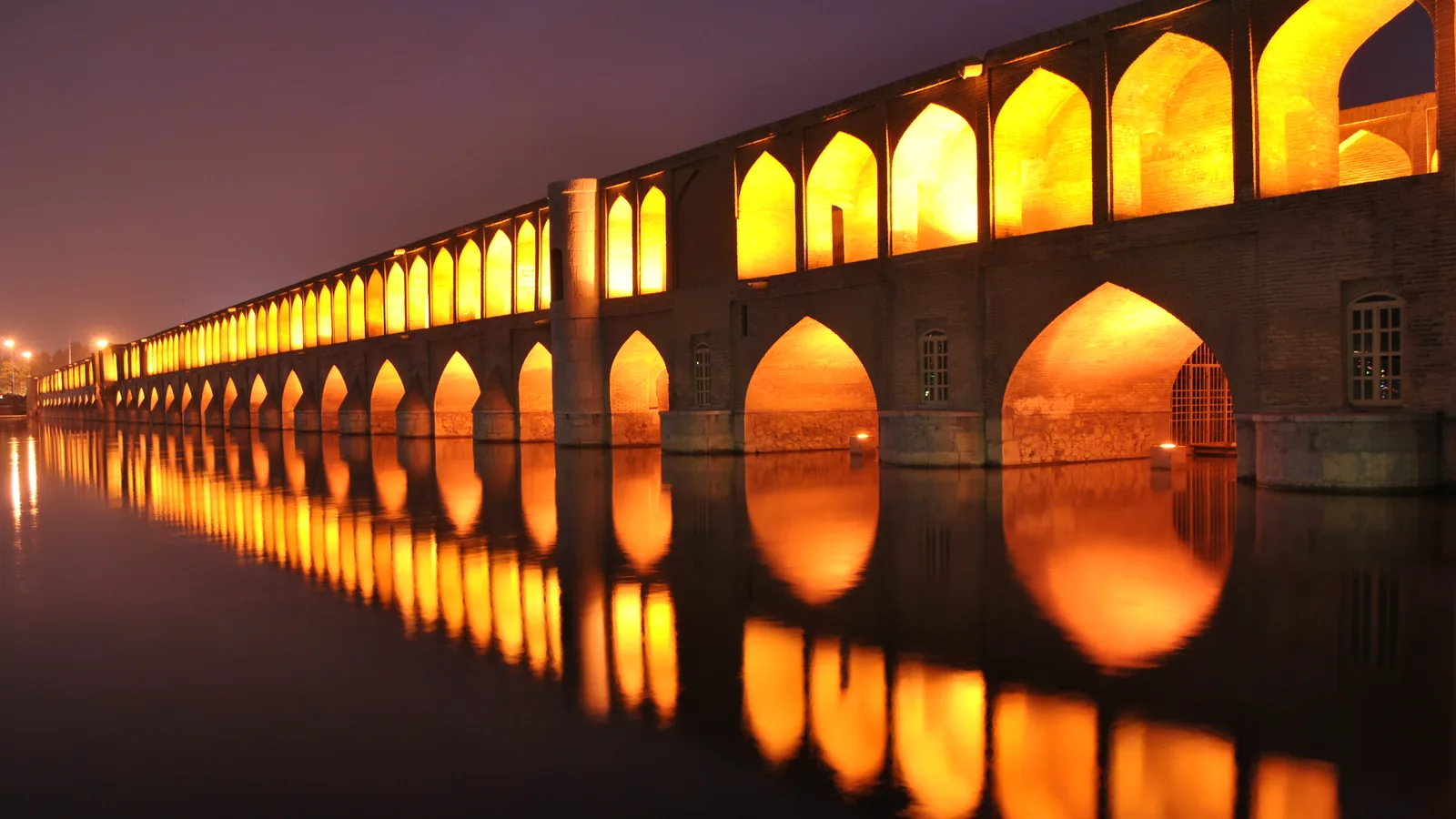
The Chahar Bagh ran from a gate of the old city to the Allahverdi Khan bridge of 1602 to 1603 and on through the Hazar Jarib gardens. Its width reached 48 meters; its length, by travelers’ differing measurements, two to two and a half miles. Savory wrote that all sources agree the shah never meant it as a highway. Water fell down stone channels in the middle, and plane trees, cypresses, pines and junipers lined the walks on either side.

English adventurers, an Italian traveler, and Hormuz
Anthony Sherley and his brother Robert reached Qazvin in the fall of 1598. Anthony went off to raise a European alliance against the Ottomans and failed; Robert stayed behind, in Ronald Ferrier’s words, “as a hostage providing tuition in cannon construction.” Pietro della Valle, an Italian traveler, lived in Isfahan from 1617 to 1619 and left accounts of polo, archery and animal fights on the square.
Portugal had held the island of Hormuz at the mouth of the Persian Gulf since 1515. In 1622 Emamqoli Khan, son of the gholam general Allahverdi Khan, took Qeshm and Hormuz with the East India Company’s ships. Willem Floor’s Iranica entry on Hormuz calls it naval help; Ferrier’s entry on Anglo-Iranian relations describes coercion, with the Persians holding back the raw silk the English had bought until the Company’s ships ferried the troops across.
New Julfa and the silk monopoly of 1619
In the fall of 1603 Abbas spent three days as the guest of Julfa’s Armenian merchants on the Aras river. A year later, retreating before an Ottoman counterattack, he ordered the population of the province driven into Iran and its crops and pastures destroyed. The Armenian chronicler Arakel of Tabriz recorded the deportation as taking place between October 21 and November 19, 1604. Vazken Ghougassian’s Iranica entry puts the number moved across the whole province at more than 400,000, a figure from the Armenian side that no other count checks. Julfa itself was leveled.
The merchants fared better than the villagers. They had three days’ notice and leave to take their movable wealth, and in early summer 1605 began building New Julfa on crown land on the right bank of the Zayandeh Rud. Della Valle found 10 churches there by 1619. That year Abbas granted the settlers the land outright, declared the export of silk a crown monopoly, raised the price, and set the Julfans against the East India Company: the English had trading privileges for their help against the Portuguese, the Armenians the right to carry Iranian raw silk to Europe. Della Valle compared them to the Genoese merchants who served the Spanish crown: the merchants could not survive without the king, nor the king without them.
Jean Chardin, a Huguenot jeweler who made three journeys to Isfahan between 1666 and 1676, called Julfa “the Dwelling-place of all the Christian Armenians.” He watched the corporation of Armenian merchants made to buy a 53-carat diamond from the king’s mother for 100,000 livres; a week later they offered it to him at a third off. He also wrote that “the Armenians manage alone the whole European trade.” After Abbas died in 1629 the monopoly loosened, and the Julfans bought silk straight from the peasants who grew it. The square carried a shah’s name on its mosque; the trade that filled its bazaar belonged to them.
Key facts
- The Meydan-e Naqsh-e Jahan measures 524 by 158 meters; its outline and the Qaysariya bazaar were begun in the Islamic year 1001, 1592 to 1593 (Haneda and Matthee).
- The Masjed-e Shah was begun in 1611 and was all but complete by Abbas’s death in 1629; additions continued to 1667.
- Abbas proclaimed Isfahan his seat of government in 1006, 1597 to 1598, yet stayed there less than two months a year on average.
- The Chahar Bagh reached 48 meters in width and ran between two and two and a half miles, by measurements that vary from Kaempfer to Le Bruyn (Savory).
- Arakel of Tabriz dated the Julfa deportation to October 21 to November 19, 1604; New Julfa was begun in early summer 1605 and granted to its settlers in 1619.
- In 1619 Abbas made the export of raw silk a crown monopoly and set the Julfa Armenians against the English East India Company (Ghougassian).
- Emamqoli Khan took Qeshm and Hormuz in 1622 with East India Company ships, after the Persians detained the Company’s silk (Floor; Ferrier).
- Chardin counted 162 mosques, 48 madrasas, 1,802 caravansaries and 273 bathhouses in late 17th-century Isfahan (Babaie).
FAQ
How big is Naqsh-e Jahan Square?
The Encyclopaedia Iranica gives 524 by 158 meters. The outline was begun in 1592 to 1593, and the shops, caravansaries and coffeehouses around it were finished by 1603.
When did Shah Abbas move the capital to Isfahan?
The court chroniclers Eskandar Beg and Molla Jalal both give the Islamic year 1006, 1597 to 1598. Haneda and Matthee add that Abbas spent under two months a year there and that the court was wherever the shah was.
Why were the Armenians of Julfa moved to Isfahan?
In 1604 Abbas burned the country ahead of an Ottoman counterattack and deported the population of the province. The Julfa merchants, who handled the raw silk trade, were resettled on crown land at New Julfa and in 1619 given the right to export Iranian silk to Europe.
Sources
- Encyclopaedia Iranica — Roger M. Savory, "ʿABBĀS I," Vol. I, Fasc. 1, pp. 71-75 (December 15, 1982; updated May 3, 2018): accession on 10 Dhu'l-Qa'da 996 / October 1, 1588; the gholam corps; Herat 1598; Sufian and Sarab 1618; Masjed-e Shah begun 1020/1611; Hormuz 1622.
- Encyclopaedia Iranica — Masashi Haneda and Rudi Matthee, "ISFAHAN vii. SAFAVID PERIOD," Vol. XIII, Fasc. 6, pp. 650-657 (December 15, 2006; updated March 30, 2012): the square at 524 x 158 m; the outline begun in 1001; 1006/1597-98 proclamation; Blake and Babaie; less than two months a year; population estimates.
- Encyclopaedia Iranica — Roger M. Savory, "ČAHĀRBĀḠ-E EṢFAHĀN," Vol. IV, Fasc. 6, pp. 625-626 (December 15, 1990; updated May 7, 2013): maximum width 48 m; Kaempfer and Le Bruyn measurements; not a highway; the Wednesday promenade from 1018/1609.
- Encyclopaedia Iranica — Vazken S. Ghougassian, "JULFA i. SAFAVID PERIOD," Vol. XV, Fasc. 2-3, pp. 217-231 (September 15, 2009; updated May 14, 2018): the deportation of October 21 to November 19, 1604 after Arakel of Tabriz; New Julfa begun in early summer 1605; della Valle's 10 churches; the 1619 land grant and silk monopoly; Chardin quoted.
- Encyclopaedia Iranica — Ronald W. Ferrier, "ANGLO-IRANIAN RELATIONS i. Safavid to Zand Periods," Vol. II, Fasc. 1, pp. 41-46 (December 15, 1985; updated August 25, 2016): the Sherleys at Qazvin in autumn 1598; the James at Jask on December 2, 1616; silk detained before Hormuz; half the customs of Bandar Abbas.
- Encyclopaedia Iranica — Willem M. Floor, "HORMUZ ii. Islamic Period," Vol. XII, Fasc. 5, pp. 471-476 (December 15, 2004; updated June 28, 2015): Portuguese rule from March 1515; Bahrain 1602; Gamru 1614; Qeshm and Hormuz 1622; the fort's stones reused.
- Encyclopaedia Iranica — Sussan Babaie, "ISFAHAN x. MONUMENTS," Vol. XIV, Fasc. 1, pp. 6-40 (December 15, 2007; updated April 5, 2012): Chardin's count of 162 mosques, 48 madrasas, 1,802 caravansaries and 273 bathhouses; "Isfahan, half the world" in Eskandar Beg.
- Internet Archive — Sir John Chardin's Travels in Persia, translated by Edmund Lloyd, vol. 1 (London, 1720): Julfa as "the Dwelling-place of all the Christian Armenians"; the Armenian merchants made to buy a 53-carat diamond.
Cite this article
- APA
- Our Earth's History. (2026, September 21). Naqsh-e Jahan: the 524-meter square of Shah Abbas's Isfahan. Our Earth's History. https://ourearthshistory.com/west-asia/early-modern/naqsh-e-jahan-isfahan-shah-abbas-square/
- Chicago
- Our Earth's History. “Naqsh-e Jahan: the 524-meter square of Shah Abbas's Isfahan.” Our Earth's History, September 21, 2026. https://ourearthshistory.com/west-asia/early-modern/naqsh-e-jahan-isfahan-shah-abbas-square/.
- MLA
- “Naqsh-e Jahan: the 524-meter square of Shah Abbas's Isfahan.” Our Earth's History, 21 Sep. 2026, https://ourearthshistory.com/west-asia/early-modern/naqsh-e-jahan-isfahan-shah-abbas-square/.
Text licensed CC BY-NC-ND 4.0. Found an error? Tell us.