Twenty sources in the margin: the Piri Reis map of 1513
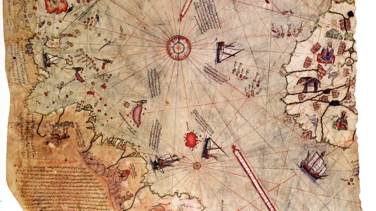

TL;DR — A 1513 Ottoman world map names about twenty source charts in its margin, including one by Columbus. Found at Topkapi in 1929, roughly a third survives, and a 1966 Antarctica claim about it has been rebutted.
“Hususan yirmi miktar hartiler ve Yappamondolar(Mappa Mondo)dan . . . bir dahi Kolonbo’nun Garp tarafında yazdığı hartiden bir kıyas üzerine istihraç edip bu şekil hâsıl oldu,” reads one of the map’s own inscriptions, as the Türk Tarih Kurumu’s 1935 commentary transcribes it. From about twenty charts and world maps, including one drawn by Columbus of the western regions, this form was derived by comparison. A separate inscription dates the work to 919 AH, the month of Muharram, which the same commentary converts to between March 9 and April 7, 1513, and names the place of drawing as Gallipoli.
Quick facts
- When
- 919 AH, the month of Muharram (March 9 to April 7, 1513), by the map's own inscription; found at Topkapi Palace in 1929; presented to Sultan Selim I in Egypt in 1517
- Where
- Drawn at Gallipoli, in the Ottoman Empire; found in the library of Topkapi Palace, Istanbul
- Who
- Ottoman admiral Piri Reis (Ahmed Muhiddin Piri); named in discovery accounts, National Museums Director Halil Ethem (also given as Halil Edhem) and, in another account, German theologian Gustav Adolf Deissmann
- Outcome
- About a third of the original gazelle-skin map survives, showing the Atlantic coasts. Its margin names roughly twenty source charts, including one by Columbus. A 1966 claim that it depicts Antarctica has been rebutted on documented grounds
Twenty charts, and a slave's story of three voyages
The same commentary gives the full list behind the margin note: eight Ptolemaic charts, one Arabic map of India, four recent Portuguese charts of Sindh, India and China, and one chart of the west drawn by Columbus. A separate inscription names the source of the Columbus material. It reads, in the original, “Merhum Gazi Kemalin İspanyalı bir kulu vardı, mezbur kul Kolonbo ile üç defa ol diyara vardım, deyu merhum Kemal Reise hikâyet edip eydür” — a Spanish slave of the late Kemal Reis, Piri Reis’s uncle, is recorded telling Kemal Reis that he had gone to that land three times with Columbus. Of the finished map, the same commentary adds, “İkinci bir nokta da haritanın bir kopya olmayıp, muhtelif haritalardan ve Reisin ve dostlarının müşahedelerinden istifade suretile yapılmış orijinal bir eser olmasıdır” — the map is not a copy, but an original work made using various charts and the observations of Reis and his friends.
Gazelle skin, one third surviving
The Ohio State University Libraries’ map history blog describes the object: “Drawn on gazelle skin, it is estimated that only about a third of the original map has survived.” Gregory C. McIntosh, a map historian and vice president of the California Map Society, gives the surviving fragment’s dimensions in his study “Columbus and the Piri Reis Map of 1513”: about 35 by 25 inches (90 by 65 centimeters), with the central and eastern portions missing, against a complete map he estimates at roughly 55 by 65 inches (140 by 165 centimeters). What remains shows, in McIntosh’s words, “Western Africa, the Atlantic Ocean, South America, some of North America and the Caribbean Sea.” The map carries thirty inscriptions in total; McIntosh notes that all but one are in Ottoman Turkish, the exception being an Arabic inscription that names the mapmaker as Piri Reis and dates the map to the spring of 1513.
1929, and three accounts of a discovery
The Türk Tarih Kurumu’s reprinted 1935 commentary states that the map was found by National Museums Director Halil Ethem in 1929, while Topkapi Palace was being converted into a museum of antiquities, and that a German orientalist, Kahle, examined it with him and reported the finding to the 18th Congress of Orientalists at Leiden in September 1931. Afetinan’s 1954 book, The Oldest Map of America Drawn by Piri Reis, published by the same Turkish institution, gives a specific day: “Mr. Halil Edhem, Director of the National Museums, discovered a map (9 Nov. 1929) till then unknown in the world.” The Ohio State University Libraries’ account differs on both the day and the finder: “On October 9, 1929, Gustav A. Deissmann, while cataloging non-Arabic materials for the Turkish Ministry of Education, was given some old bundles of maps that had been hidden away in Topkapi Palace,” and it was Deissmann, in this version, who realized he had found a fragment of a 1513 world map. The three accounts agree only on the year.
Piri Reis, the Kitab-i Bahriye and two dates of death
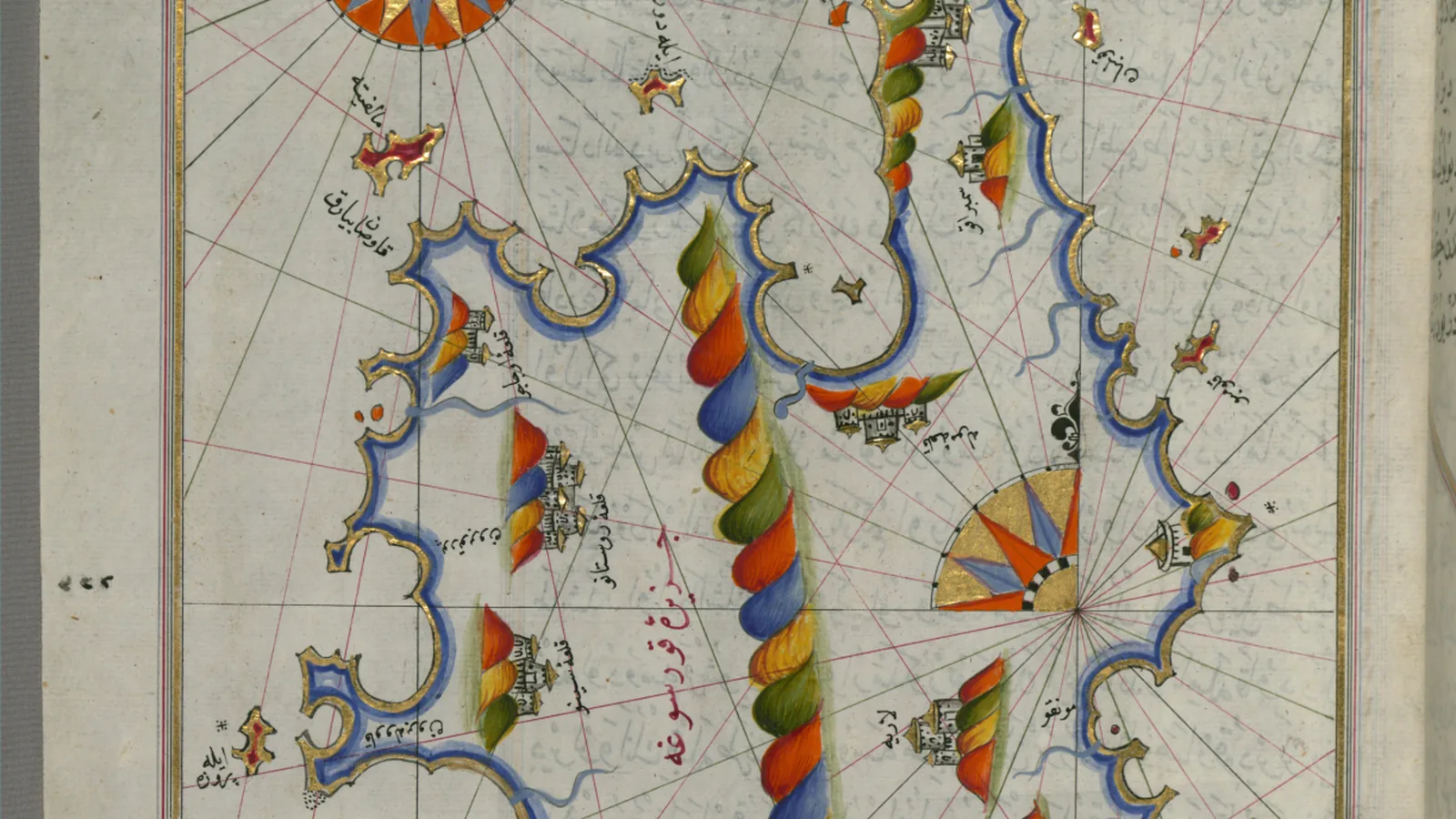
McIntosh writes that Piri Reis was born Muhiddin Piri around 1465, probably in Gallipoli, joined his uncle Kemal Reis as a young man, and after Kemal Reis died in 1510 returned to Gallipoli, where he drew the 1513 map. In 1517, the Türk Tarih Kurumu commentary states, he presented it to Sultan Selim I while the sultan was in Egypt; Afetinan’s account places the meeting more specifically during the battle of Alexandria. McIntosh dates Piri Reis’s navigational handbook, the Kitab-i Bahriye, to 1521 for its compilation and 1526 for a revised version presented to Sultan Suleiman. Afetinan describes multiple surviving copies, some dated 1520 (Arabic 927), others 1525 (Arabic 932), with the revised dedication’s verse giving “1526 A.D. (923 by the Arabic Calendar).” The Walters Art Museum, describing its own copy, W.658, states that the work was “originally composed in 932 AH/AD 1525 and dedicated to Sultan Süleyman I (‘The Magnificent’),” and that the manuscript itself, made in the late 17th century AD, is based on a later expanded version with “some 240 exquisitely executed maps and portolan charts,” including a world map with the outline of the Americas. McIntosh and Afetinan both give Piri Reis’s death as 1554; the Walters Art Museum gives “d. 962 AH/AD 1555.” None of the three sources gives a day or month.

Charles Hapgood's Antarctica claim, and its rebuttal
The claim that the map’s southern landmass depicts Antarctica traces to Charles Hapgood’s 1966 book, Maps of the Ancient Sea Kings. McIntosh answers it directly: “There is little or no resemblance between Piri’s southern land and Antarctica, other than the fact that both lie south of the Atlantic Ocean and have a generally east-west coastline.” He traces the method behind the claim to two steps: Hapgood assumed that unknown ancient source maps of Antarctica were accurate, and then, to make the fit work, “ignored the place-names inscribed upon the map.” McIntosh attributes the southern landmass instead to two ordinary sources combined: a belief in a southern continent inherited from geographers since Ptolemy’s time, and Portuguese reports from voyages along the eastern coast of South America. The Türk Tarih Kurumu published its own assessment of the map’s originality in 1935, three decades before Hapgood’s book appeared.
Key facts
- The map’s own inscription dates it to 919 AH, the month of Muharram, which the Türk Tarih Kurumu’s 1935 commentary converts to between March 9 and April 7, 1513, drawn at Gallipoli.
- A margin note lists about twenty source charts: eight Ptolemaic charts, one Arabic map of India, four Portuguese charts, and one chart of the west by Columbus.
- A separate inscription records a Spanish slave of Kemal Reis saying he had sailed to that land three times with Columbus, and credits that account for the Caribbean place names.
- The surviving fragment, drawn on gazelle skin, measures about 35 by 25 inches (90 by 65 centimeters), roughly a third of the estimated original.
- Three sources give three different accounts of the 1929 discovery: the Türk Tarih Kurumu names Halil Ethem, Afetinan dates it to November 9, 1929, and Ohio State University Libraries credits Gustav Adolf Deissmann on October 9, 1929.
- Piri Reis presented the map to Sultan Selim I in Egypt in 1517, and compiled the Kitab-i Bahriye, dated 1521 or 1526 depending on the source.
- McIntosh and Afetinan give Piri Reis’s death as 1554; the Walters Art Museum gives 1555.
- Gregory McIntosh rebuts the claim that the map shows Antarctica, tracing it to Charles Hapgood’s 1966 book and to Hapgood’s disregard of the map’s own place names.
FAQ
What does the Piri Reis map's own inscription say about its sources?
It states that the map was compiled from about twenty charts and world maps, among them eight Ptolemaic charts, an Arabic map of India, four Portuguese charts, and a chart of the western regions drawn by Columbus, as reprinted in the Türk Tarih Kurumu's 1935 commentary.
Who found the Piri Reis map in 1929, and on what date?
Accounts differ. The Türk Tarih Kurumu's 1935 commentary names Halil Ethem, director of the National Museums, in 1929. Afetinan's 1954 book gives the date as November 9, 1929, with the same finder. Ohio State University Libraries credits German theologian Gustav Adolf Deissmann, on October 9, 1929.
Does the Piri Reis map show Antarctica?
Gregory McIntosh, in his study of the map, finds little resemblance between its southern landmass and Antarctica beyond both lying south of the Atlantic with a roughly east-west coastline. He attributes the claim, which originated with Charles Hapgood's 1966 book, to Hapgood's disregard of the map's own place names and to unverified assumptions about lost ancient source maps.
Sources
- Türk Tarih Kurumu, "Pirî Reis Haritası Hakkında İzahnâme" (1935 commentary, reprinted in full)
- Gregory C. McIntosh, "Columbus and the Piri Reis Map of 1513"
- Ohio State University Libraries, "1513 / World Map / Piri Reis," Wind Rose blog
- The Walters Art Museum, "Book on Navigation" (Kitab-i Bahriye, W.658)
- Afetinan, The Oldest Map of America Drawn by Piri Reis, tr. Leman Yolaç (Ankara: Türk Tarih Kurumu Basımevi, 1954)
Cite this article
- APA
- Our Earth's History. (2026, September 26). Twenty sources in the margin: the Piri Reis map of 1513. Our Earth's History. https://ourearthshistory.com/west-asia/early-modern/piri-reis-map-1513-twenty-sources-margin-notes-topkapi-1929/
- Chicago
- Our Earth's History. “Twenty sources in the margin: the Piri Reis map of 1513.” Our Earth's History, September 26, 2026. https://ourearthshistory.com/west-asia/early-modern/piri-reis-map-1513-twenty-sources-margin-notes-topkapi-1929/.
- MLA
- “Twenty sources in the margin: the Piri Reis map of 1513.” Our Earth's History, 26 Sep. 2026, https://ourearthshistory.com/west-asia/early-modern/piri-reis-map-1513-twenty-sources-margin-notes-topkapi-1929/.
Text licensed CC BY-NC-ND 4.0. Found an error? Tell us.