Peak XV becomes Mont Everest in a letter Andrew Waugh sent in 1856
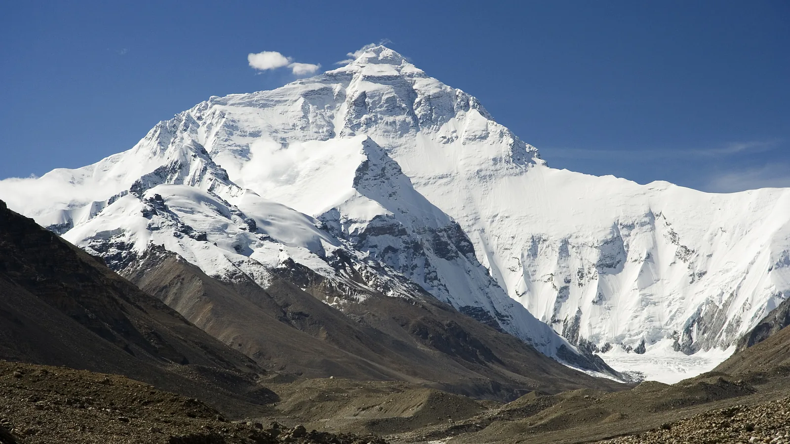

TL;DR — Andrew Waugh’s 1856 letter named Peak XV “Mont Everest” at 29,002 feet and thanked only his assistant J. Hennessey, not Radhanath Sikdar.
“Here is a mountain, most probably the highest in the world, without any local name that we can discover,” Andrew Scott Waugh wrote from Dehra on March 1, 1856. Waugh, the Surveyor-General of India, was naming a summit the Great Trigonometrical Survey had listed only as Peak XV, invoking his “respected chief and predecessor, Colonel Geo. Everest,” who had taught him “to assign to every geographical object its true local or native appellation.” The letter reached London and was read to the Royal Geographical Society on May 11, 1857, with the survey’s figures: latitude 27 degrees 59 minutes 16.7 seconds north, longitude 86 degrees 58 minutes 5.9 seconds east, height 29,002 feet.
Quick facts
- When
- March 1, 1856 (Waugh's letter, read to the society May 11, 1857) · December 8, 2020 (Nepal-China joint announcement)
- Where
- Dehra, India (the letter's dateline); the Royal Geographical Society, London; Kathmandu and Beijing
- Who
- Andrew Scott Waugh, Surveyor-General of India; his assistant J. Hennessey; Colonel George Everest; Radhanath Sikdar, Chief Computer at the Calcutta office; B. L. Gulatee; Xi Jinping and Bidya Devi Bhandari
- Outcome
- Waugh named Peak XV "Mont Everest" and gave its height as 29,002 feet, thanking Hennessey but naming no one else; a dispute over Sikdar's role began in 1904 and continued in scholarship through 2016; Nepal and China jointly announced a height of 8,848.86 meters in 2020
Waugh names the peak after his predecessor
Waugh closed his letter with credit to one man. “In justice to my able assistant J. Hennessey, Esq., it is proper to acknowledge, that I am greatly indebted to him for his cordial co-operation in revising these computations,” he wrote. The name he chose honored Colonel George Everest, whom Waugh had served as chief assistant since 1832 before succeeding him as Surveyor-General in December 1843. No other computer is named in the printed letter, which does not mention Radhanath Sikdar, whom later accounts credit with calculating the mountain’s height.
1857: Everest objects, then seconds the motion
Colonel Everest was present when the letter was read and spoke against attaching his name to the peak. The society’s minutes record his objections: “his name was not pronounceable by a native of India. The name could not be written in either Persian or Hindi, and the natives could not pronounce it. It would be confounded with that of O’Brien, and the hill people would probably call this mountain Ob’ron.” The minutes then record the outcome in one line: “Colonel Everest having seconded the proposition, it was carried unanimously.”

A computer's name enters the record in 1904
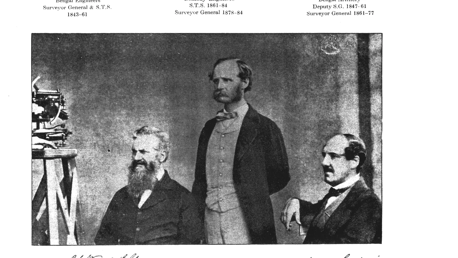
The story that a Calcutta office worker first spotted the mountain’s height does not appear in Waugh’s 1856 letter. It surfaces in an article the then Surveyor-General of India, S. G. Burrard, published in Nature on November 10, 1904, according to Ashish Lahiri’s 2016 paper in the Indian Journal of History of Science. Burrard wrote that “about 1852 the chief computer of the office at Calcutta informed Sir Andrew Waugh that a peak designated XV had been found to be higher than any other hitherto measured in the world.” Lahiri identifies that computer as Radhanath Sikdar, Chief Computer at the Calcutta head office from 1849 until his retirement in 1862. J. R. Smith, George Everest’s official biographer, wrote in his 1999 book Everest: the Man and the Mountain that “there is only contrary evidence available,” since Sikdar was in Calcutta while the computation work was taking place in Dehra Dun. John Keay’s 2001 book The Great Arc took the opposite view, judging it “quite probable that Sickdhar’s computations provided the first clear proof of XV’s superiority.”
Lahiri examined correspondence at the National Archives in New Delhi from January 1851 to November 1861 between Sikdar in Calcutta and survey officials including Waugh, covering subjects such as “Computation of Heights” and, on September 17, 1851, what Lahiri describes as “two huge papers explaining at length, with equations, diagrams and illustrations, the Method of Minimum Squares.” He also cites a letter Waugh sent Sikdar on August 25, 1856: “I am glad that the name I have given to the highest snowy peak has given satisfaction to yourself as well as other superior members of the Department.” Lahiri concludes that Sikdar “was certainly not the ‘discoverer’ of Mount Everest,” but calls him “the pivot round whom the computations were conducted.”
The height changes twice more before 2020
A paper in the Journal on Geoinformatics, Nepal, written by authors including staff of Nepal’s government survey department, lists the height’s later history. J. W. Armstrong measured 8,779 meters in 1847. Waugh and Nicholson’s 1849 figure, the one Waugh reported to London in 1856, was 8,840 meters. Burrard recalculated 8,882 meters in 1905, and B. L. Gulatee’s 1954 calculation produced 8,848 meters (29,028 feet). Chinese surveyors measured 8,848.13 meters in 1975 and 8,844.43 meters in 2005. After the 2015 earthquakes, Nepal’s survey department ran trigonometrical, GNSS and gravity survey across 297 control points, and a Nepali team reached the summit with GNSS equipment in 2019. An abstract the same authors presented to the International Federation of Surveyors in Amsterdam in May 2020 said fieldwork had begun in 2018 and the new height was “expected to come early 2020,” calculated from the summit’s ellipsoid height and a precise geoid model.
Kathmandu and Beijing announce 8,848.86 meters
On December 8, 2020, Nepal and China announced the new figure jointly by video link from Kathmandu and Beijing. The State Council Information Office of the People’s Republic of China reported the outcome: “Qomolangma, known in the West as Mount Everest . . . now stands at 8,848.86 meters in the record books, according to an announcement made by the two countries on Dec. 8.” The announcement took the form of an exchange of letters between Chinese President Xi Jinping and Nepali President Bidya Devi Bhandari. Li Guopeng, who led China’s First Geodetic Surveying Brigade, said the team “chose more than 70 core members who are physically strong and experienced climbers.”
Key facts
- Waugh’s letter of March 1, 1856, gave Peak XV’s height as 29,002 feet at 27°59‘16.7” N, 86°58‘5.9” E (RGS Proceedings, 1857).
- The letter thanks only “my able assistant J. Hennessey, Esq.”; Sikdar’s name does not appear in it.
- Everest objected to the name over pronunciation, then seconded the motion, carried unanimously on May 11, 1857.
- Waugh became Surveyor-General of India in December 1843, succeeding Everest, who had held the post since 1823.
- Burrard’s Nature article of November 10, 1904, first credited a Calcutta computer with alerting Waugh to the peak around 1852.
- Sikdar served as Chief Computer at the Calcutta office from 1849 to 1862, per Lahiri’s 2016 National Archives research.
- Gulatee’s 1954 calculation produced 29,028 feet (8,848 meters), the figure Nepal’s 2020 survey paper cites for that year.
- Nepal and China jointly announced 8,848.86 meters on December 8, 2020, through letters exchanged by their presidents.
FAQ
Did Andrew Waugh's 1856 letter name Radhanath Sikdar?
No. The letter, printed in the Royal Geographical Society's Proceedings for 1857, thanks only "my able assistant J. Hennessey, Esq."
What height did Waugh report for Peak XV in 1856?
29,002 feet, at 27°59'16.7" north and 86°58'5.9" east, as printed by the Royal Geographical Society.
What is Mount Everest's currently announced height?
8,848.86 meters, announced jointly by Nepal and China on December 8, 2020, from a 2019 summit GNSS survey and a precise geoid model.
Sources
- Andrew Scott Waugh, "Papers relating to the Himalaya and Mount Everest," Proceedings of the Royal Geographical Society of London, Vol. I (1857), pp. 345-351, 370-371, read May 11 and 25, 1857
- Ashish Lahiri, "Radhanath Sikdar and the Final Phase of Measuring Peak XV," Indian Journal of History of Science, Vol. 51, No. 2.1 (2016), pp. 280-288
- Susheel Dangol, Prakash Joshi, Suraj KC, Mahesh Thapa, Bigyan Banjara, Shanker KC and Stallin Bhandari, "Measurement of Height of Mt. Sagarmatha," Journal on Geoinformatics, Nepal (2020), p. 58
- Susheel Dangol, Prakash Joshi, Bigyan Banjara and Mahesh Thapa, "Sagarmatha (Mt. Everest) Height Measurement," International Federation of Surveyors Working Week 2020, Amsterdam, May 10-14, 2020
- State Council Information Office of the People's Republic of China, "How Qomolangma rose to new heights," December 24, 2020
Cite this article
- APA
- LETTER. (2026, September 28). Peak XV becomes Mont Everest in a letter Andrew Waugh sent in 1856. Our Earth's History. https://ourearthshistory.com/south-asia/modern/peak-xv-great-trigonometrical-survey-waugh-1856-highest-mountain/
- Chicago
- LETTER. “Peak XV becomes Mont Everest in a letter Andrew Waugh sent in 1856.” Our Earth's History, September 28, 2026. https://ourearthshistory.com/south-asia/modern/peak-xv-great-trigonometrical-survey-waugh-1856-highest-mountain/.
- MLA
- LETTER. “Peak XV becomes Mont Everest in a letter Andrew Waugh sent in 1856.” Our Earth's History, 28 Sep. 2026, https://ourearthshistory.com/south-asia/modern/peak-xv-great-trigonometrical-survey-waugh-1856-highest-mountain/.
Text licensed CC BY-NC-ND 4.0. Found an error? Tell us.