At Rima, Kingdon-Ward heard the 1950 earthquake end in explosions

TL;DR — The eastern Himalayan earthquake of August 15, 1950 is catalogued at magnitude 8.6 to 8.8; its deaths were counted in separate pieces, and no single total exists.
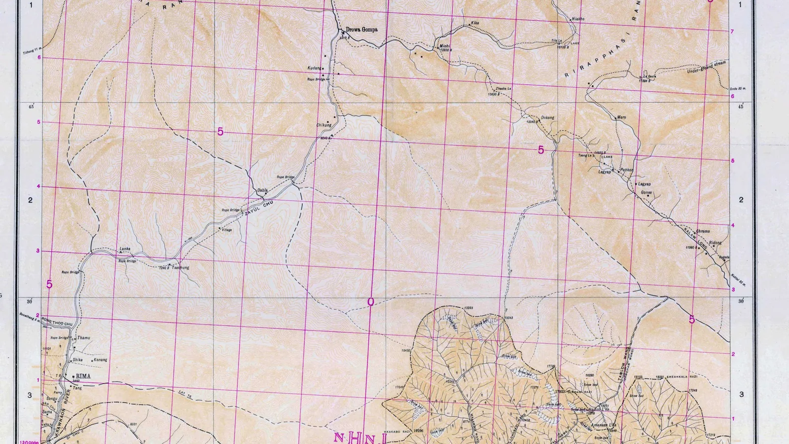
“The earthquake struck without warning an hour after dark on the night of 15 August 1950,” the plant hunter Frank Kingdon-Ward wrote in The Geographical Journal in 1953. He and his wife were camped outside Rima, a village in the Lohit valley in the Zayu area of Tibet, close to the epicenter, and the seismologist Charles F. Richter called his report the only on-the-spot account available. The U.S. Geological Survey (USGS) dates the shock to 14:09 UTC and gives it a magnitude of 8.6; other seismologists have calculated 8.7 and 8.8. Landslides in the hills of what is now Arunachal Pradesh dammed rivers that burst days later. Deaths were counted separately for Assam, for Tibet and for a flood on the Subansiri River, and no published figure combines them. Field studies in 2017 and 2020 found where the fault broke the ground.
Quick facts
- When
- August 15, 1950, at 14:09 UTC, about 8 p.m. local time at Rima · September 7, 1950 (Kingdon-Ward leaves Rima) · eight days after the shock (the Subansiri dam breaks) · November 2, 1950 (Kingdon-Ward reaches the Tidding valley) · 1953 (his paper in The Geographical Journal) · 2017 and 2020 (field studies of the fault rupture)
- Where
- The epicentral area near Rima in the Zayu area of Tibet; the Lohit valley, the Mishmi Hills and the Abor Hills, in what is now Arunachal Pradesh, India; the Sibsagar-Sadiya area of Assam; the Subansiri River; Pasighat and Wakro
- Who
- Frank Kingdon-Ward and his wife; the Assam Rifles; the Assistant Political Officer at Walong and his porters; the seismologist Charles F. Richter; the U.S. Geological Survey; NOAA's National Centers for Environmental Information; the authors of the 2017 Scientific Reports and 2020 Earth and Planetary Science Letters studies
- Outcome
- The USGS catalogue gives magnitude 8.6; other calculations give 8.7 and 8.8. Deaths were counted in pieces (1,526 or 1,530 in Assam, at least 780 in Tibet, 532 or 536 in the Subansiri flood), and the USGS states that the true toll may be much higher. The 2020 study traced a surface rupture at least 200 km long
August 15, 1950, about 8 p.m., outside Rima village
The couple lay on the ground outside their tent, pitched on a low sandhill by the village. Kingdon-Ward felt no warning tremors beyond an almost imperceptible jolt, and he wrote: “We reckoned that the main shock lasted five or six minutes.” The motion seemed vertical, and the vibration was fast enough to suggest “the roll of kettledrums.” In the dark he could see the ridges against the paler sky, their pine trees dancing, as whole hillsides slid into the valley.
The strangest noises came at the end. Five or six explosions, “all exactly alike,” followed one another at intervals of several seconds, and he wrote that “they sounded like Ack-Ack shells bursting high in the sky.” They seemed to come from the north-west, over the valley of the Rong Thé Chu, where seismologists later placed the epicenter. He recorded that they were heard on the plain of Assam, 150 miles away, and in Myitkyina in northern Burma, 200 miles away. Richter, in his 1958 textbook Elementary Seismology, gave a wider reach: sounds heard at many points in India and Burma “to distances of over 750 miles.” He added that the sounds had since been specially investigated.
Kingdon-Ward's three weeks in the Rima basin
In Rima every log house lost its roof of stone-weighted shingles, and the pens built against the houses, where pigs and cattle slept, “were completely destroyed, killing many of the inmates.” At Shigathang the shock threw the timber monastery off its plinth onto its side.
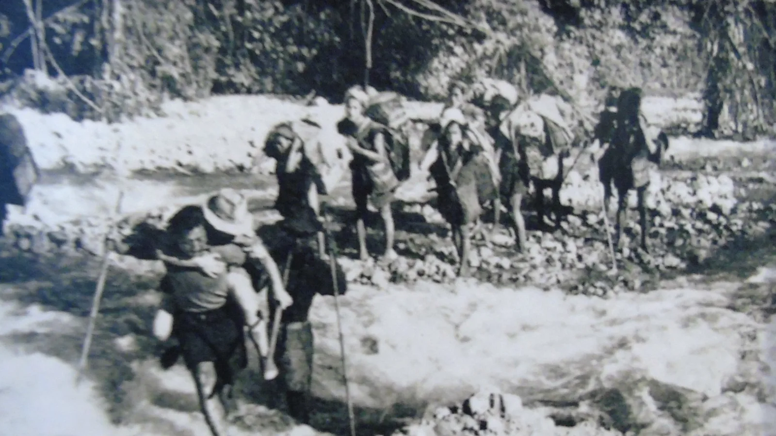
Landslides went on for months, and hundreds of rock avalanches a day kept the air thick with white dust. The La Ti torrent, blue-green and clear the day before, ran from August 16 as “thick soup.” The rope bridge over the Lohit had gone early, which left the couple marooned. They heard that a Mishmi village on a spur had been buried without trace. On September 1 a patrol of the Assam Rifles walked in, almost out of rations. Local men and the villagers of Samé got two rope bridges across by September 6, and the party left for Walong the next morning.
At Samé a rescue party of the Assam Rifles brought a note from the Assistant Political Officer. His camp had been buried under an avalanche of rock “which had killed three of the porters and injured several people.” The worst damage he saw lay nearer the plains. On November 2 the couple reached the Tidding valley, where a blocked river had broken through “some days later,” not on the night of the shock. “A wall of water 60 feet high had rushed at headlong speed past Theronliang, carrying the rest house and everything else with it,” he wrote. The valley was twice its former width.

Recorded at 8.6, 8.7 and 8.8
The USGS catalogue puts the source at 28.36 degrees north and 96.45 degrees east, 15 km deep, and cites a 1977 paper by the seismologist H. Kanamori for its magnitude of 8.6. Its event page states that “Magnitude 8.6 is a better determination of the size of this earthquake.” Richter had given 8.7. A table in the 2020 study lists the other results: 8.6 from Gutenberg and Richter in 1954 and from Chen and Molnar in 1977, 8.7 from Okal in 1992 and from the 2020 authors, and 8.8 from Ben-Menahem and colleagues in 1974. The same teams disagreed on the fault type: normal, strike-slip or thrust.
Shaking reached intensity X, the USGS grade for severe damage, at Sadiya, Pasighat, Dibrugarh and Sibsagar in Assam, and was felt as far away as Calcutta. Water in lakes and fjords of Norway and in at least three English reservoirs rocked back and forth. Richter recorded that one aftershock a few days later was felt more widely in Assam than the main shock, and that journalists concluded it must be “the greatest earthquake of all time.” He called this a confusion between magnitude, the size of the source, and intensity, the strength of shaking at a place.
"The actual casualty toll may be much higher"
The deaths in Assam are given as 1,526 in NOAA’s 1992 catalogue and in Bruce Bolt’s 1993 book Earthquakes, and as 1,530 in Karl Steinbrugge’s 1982 survey and in the database of NOAA’s National Centers for Environmental Information, which also lists damage of 20 million dollars. The USGS counts “at least 780 people killed” in the Nyingchi-Qamdo-Zhamo area of eastern Tibet, which includes Rima and Zayu. In the Medog area, the village of Yedong slid into the Yarlung Zangbo, the upper Brahmaputra, and was washed away.
The Abor Hills lost about 70 villages, mostly to landslides, and the International Seismological Summary counted 156 casualties there. Slides also blocked the Subansiri River. The natural dam broke eight days later and sent a wave 7 meters high over several villages. The USGS gives 536 dead; the International Seismological Summary gives 532.
The USGS explains the gap. Many sources call the event the Assam earthquake, although nearly all place the epicenter in Tibet, so the Tibetan dead and the Subansiri flood victims may be missing from the usual figure; the study by Gu and colleagues gives no totals for Yedong or the worst-hit Tibetan areas. The page concludes that “the actual casualty toll may be much higher than the value given.” No institution cited below publishes a single combined count.
Fault scarps at Pasighat and Wakro
Great Himalayan earthquakes of the 19th and 20th centuries were long thought to have struck on blind faults, which leave no break at the surface. In 2017 a team that included the Geological Survey of India reported in Scientific Reports on a trench dug across a fault scarp about 3.1 meters high at Pasighat. Radiometric dating of the trench layers and charcoal, including isotopes from the era of bomb testing, tied the break to 1950, with slip of 5.5 meters, give or take 0.7. The Geological Survey of India had photographed damage after the shock, but its workers never examined Pasighat, which the 2017 authors suggest was cut off by flooding.
The 2020 study by A. Coudurier-Curveur, P. Tapponnier, E. Okal and colleagues, in Earth and Planetary Science Letters, cited Kingdon-Ward’s reports for the epicenter’s place in remote mountains northeast of the Mishmi Hills. Its authors mapped aftershocks and fresh landslide scars over an area about 330 km by 100 km and traced a surface rupture at least 200 km long on two faults, the Mishmi Thrust and the Main Himalayan Frontal Thrust. The vertical offset at the surface was 7.6 meters at Wakro and more than 2.6 meters at Pasighat. Dated boulders on raised river terraces, the paper stated in 2020, “may be taken to imply bi-millennial return time for 1950-size events,” about one such earthquake every two thousand years.
Key facts
- The USGS dates the earthquake to 14:09 UTC on August 15, 1950, and gives magnitude 8.6; other calculations give 8.7 and 8.8.
- Frank Kingdon-Ward, camped outside Rima in Tibet, timed the main shock at five or six minutes (The Geographical Journal, 1953).
- He heard five or six explosions at the end of the shock and recorded that they carried 150 miles to Assam and 200 miles to Myitkyina.
- Deaths in Assam are given as 1,526 (NOAA 1992, Bolt 1993) or 1,530 (Steinbrugge 1982, NOAA NCEI database).
- The USGS counts at least 780 killed in eastern Tibet and states that the true toll may be much higher.
- A landslide dam on the Subansiri River broke eight days after the shock; its 7-meter wave killed 536 people by the USGS count, 532 by the International Seismological Summary.
- A 2020 study traced a surface rupture at least 200 km long on the Mishmi Thrust and the Main Himalayan Frontal Thrust.
FAQ
How strong was the 1950 Assam-Tibet earthquake?
The USGS catalogue gives magnitude 8.6. Richter gave 8.7 in 1958, a 2020 study calculated 8.7, and Ben-Menahem and colleagues calculated 8.8 in 1974. The 2020 study called it the largest continental earthquake ever recorded.
How many people died in the 1950 earthquake?
No single total exists. Assam's count is 1,526 or 1,530, the USGS counts at least 780 dead in eastern Tibet, and the Subansiri flood killed 532 or 536. The USGS states that the Tibetan and flood deaths may be missing from the usual figure.
Where was Frank Kingdon-Ward during the earthquake?
He and his wife were camped on a sandhill outside Rima, in the Zayu area of Tibet, near the epicenter. They stayed until September 7, 1950, then walked down the Lohit valley toward Assam.
Sources
- U.S. Geological Survey, Earthquake Hazards Program, ComCat event iscgem895681 (ISC-GEM catalogue): origin time 1950-08-15 14:09:34 UTC, location, depth and magnitude 8.6, with the official magnitude reference Kanamori (1977).
- U.S. Geological Survey, event page iscgem895681, impact text: USGS summary of damage and casualties, with excerpts from Richter (1958), Bolt (1993), Steinbrugge (1982), the NOAA catalogue of 1992 and the International Seismological Summary.
- NOAA National Centers for Environmental Information, Significant Earthquake Database, entry for August 15, 1950, INDIA-CHINA (deaths, damage, magnitudes, depth).
- F. Kingdon-Ward, "The Assam Earthquake of 1950," The Geographical Journal 119, no. 2 (June 1953), pp. 169-182, scanned text at the Internet Archive.
- A. Coudurier-Curveur, P. Tapponnier, E. Okal and others, "A composite rupture model for the great 1950 Assam earthquake across the cusp of the East Himalayan Syntaxis," Earth and Planetary Science Letters 531 (2020), 115928, open-access copy at the Nanyang Technological University repository.
- R. S. Priyanka, R. Jayangondaperumal and others, "Primary surface rupture of the 1950 Tibet-Assam great earthquake along the eastern Himalayan front, India," Scientific Reports 7 (2017), 5433, full text at PubMed Central, PMC5511192.
Cite this article
- APA
- LETTER. (2026, September 28). At Rima, Kingdon-Ward heard the 1950 earthquake end in explosions. Our Earth's History. https://ourearthshistory.com/south-asia/contemporary/assam-tibet-earthquake-1950-kingdon-ward-rima/
- Chicago
- LETTER. “At Rima, Kingdon-Ward heard the 1950 earthquake end in explosions.” Our Earth's History, September 28, 2026. https://ourearthshistory.com/south-asia/contemporary/assam-tibet-earthquake-1950-kingdon-ward-rima/.
- MLA
- LETTER. “At Rima, Kingdon-Ward heard the 1950 earthquake end in explosions.” Our Earth's History, 28 Sep. 2026, https://ourearthshistory.com/south-asia/contemporary/assam-tibet-earthquake-1950-kingdon-ward-rima/.
Text licensed CC BY-NC-ND 4.0. Found an error? Tell us.