At 5:23 a.m. on April 26, 1966, a shallow shock under Tashkent

TL;DR — A shallow shock of about magnitude 5.2 to 5.3 hit central Tashkent at 5:23 a.m. on April 26, 1966; official deaths numbered eight or 10, and over 300,000 people lost homes.
At 5:23 a.m. local time on April 26, 1966, an earthquake struck directly under Tashkent, capital of the Uzbek Soviet Socialist Republic, in what is now Uzbekistan. The historian Marcus Colla, who gives the time as 5:22, calls it the fourth biggest city in the Soviet Union. Instrumental records put the shock at a moderate size, about magnitude 5.2 to 5.3. More than 300,000 of 1.5 million residents lost their homes, according to the United Nations Development Programme (UNDP) and a 2026 paper by Uzbek seismologists. The official death toll was eight in that paper and 10 in a United States government database.
Quick facts
- When
- April 26, 1966, 5:23 a.m. local time (main shock) · May 9 and 24, June 5 and 29, July 4, 1966, and March 24, 1967 (strongest aftershocks) · October 1, 1966 (Institute of Seismology founded) · May 20, 1976 (Courage complex opened)
- Where
- central Tashkent, capital of the Uzbek Soviet Socialist Republic, in what is now Uzbekistan; the epicentral area at what are now Sharaf Rashidov Street and Abdulla Kadyri Street
- Who
- the residents of Tashkent; Soviet leader Leonid Brezhnev; building crews from across the Soviet Union; architects Sabir Adilov and Valeriy Ganiev and sculptor Dmitry Ryabichev
- Outcome
- more than 300,000 of 1.5 million residents lost their homes; the official death toll was eight (Scientific Reports, 2026) or 10 (NOAA NCEI); the city was rebuilt over three and a half years, with more than 1 million square meters of new buildings
Under the city center, 5 to 10 kilometers down
The U.S. Geological Survey (USGS) lists it, from the ISC-GEM Global Instrumental Earthquake Catalogue, at moment magnitude (Mw) 5.31, plus or minus 0.20, and places it “9 km NNW of Tashkent.” The International Seismological Centre (ISC) in Britain records a body-wave magnitude (mb) of 4.88 for its preferred solution. Mw and mb are separate scales, and the numbers are not interchangeable.
Vakhitkhan Ismailov and six co-authors, most of them from the Institute of Seismology of the Academy of Sciences of Uzbekistan, gave it in Scientific Reports in 2026 as M = 5.2 on the Richter scale. A 2004 paper for the World Conference on Earthquake Engineering, three of whose four authors worked at the same institute, gave M = 5.3.
Focal depth is the distance below the surface at which the rupture began. The ISC places it at about 5.07 kilometers, the USGS entry at 10.0 kilometers, and both Uzbek papers at 8 kilometers. Intensity, unlike magnitude, grades what the shaking did at one place, from felt effects to collapse. The 2026 paper records intensity VIII on the MSK-64 scale at the epicenter and VI on the edges of the city. Strong shaking lasted about 10 to 12 seconds.
Adobe houses in a 10-square-kilometer core
The 2026 authors named three reasons a quake of this size did so much harm: the very shallow focus, about 8 kilometers down; its position under the urban center; and local soils that amplified the shaking. They mapped four damage zones. The worst covered about 10 square kilometers of the central city, where most buildings were single-story brick and adobe and most of the badly damaged ones were over 50 years old. A belt 1 to 3 kilometers wide around that core had intensity VII.
The 2004 paper reached the same picture from the building side. Adobe houses had not been designed to resist shaking, many stood in the epicentral zone, and many had deteriorated before the earthquake. The authors wrote: “There were no cases of modern buildings collapsing.”
Before the earthquake the ground over the epicenter was Kashgar, a residential quarter of single-story houses, and the shock destroyed most of them. The architect Valeriy Ganiev told the news site Gazeta.uz in 2023 that whatever still stood there was knocked down with tanks and blown up.
Eight deaths in the official count
The Scientific Reports paper states: “While the official death toll was eight, about 200 individuals were hospitalized with varying degrees of injury.” The National Centers for Environmental Information (NCEI) of the National Oceanic and Atmospheric Administration (NOAA) records 10 deaths and damage of $300 million in its Significant Earthquake Database. The 2026 authors add that hundreds of elderly people were reported to have died of heart attacks brought on by stress and fear of aftershocks. Neither source states whether those deaths entered the official count.
The same paper lists 236 administrative buildings, about 700 brick structures, 181 educational institutions, 185 medical institutions and 245 industrial buildings as damaged or destroyed. It gives more than 2 million square meters of land as uninhabitable. The 2004 paper measures a different thing: the city’s residential floor area, which it says fell from 7.2 million square meters to 2.8 million.
By the end of December 1969, more than 1,100 aftershocks had been recorded. The strongest came on May 9 and 24, June 5 and 29, and July 4, 1966, and on March 24, 1967, reaching intensity VII.
Rebuilt in three and a half years
Soviet leader Leonid Brezhnev, Colla writes, immediately vowed to rebuild the city “more beautiful” than before, and “Armies of workers arrived from across the Soviet Union.” According to UNDP, the capital was completely reconstructed over three and a half years. New districts went up in the suburbs, and a satellite town named Sputnik appeared; more than 1 million square meters of housing, schools and public buildings were completed. Colla’s chapter, which covers 1966 to 1975, states that the project itself was portrayed as “an unprecedented achievement of Soviet solidarity and technical prowess.” The Institute of Seismology in Tashkent had been founded on October 1, 1966.
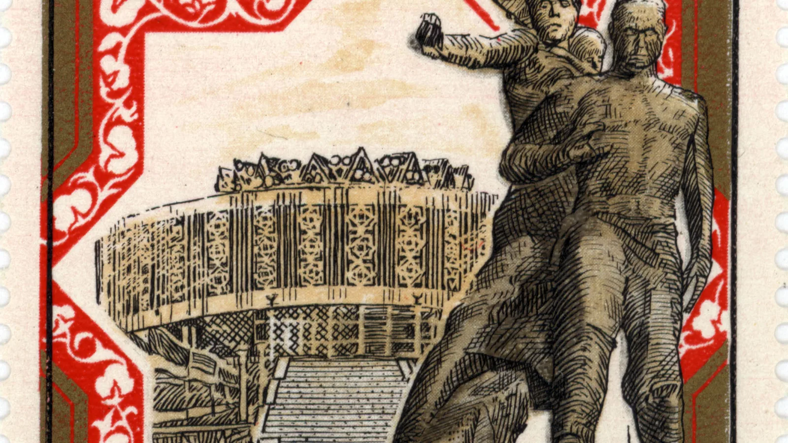
The monument came 10 years later. A site of five hectares on the epicenter, at what are now Sharaf Rashidov Street and Abdulla Kadyri Street, was assigned in October 1975, and the working group met there on October 24: Tashkent’s chief architect Sabir Adilov, the sculptor Dmitry Ryabichev and Ganiev, then 27. Ganiev said the complex was dedicated to the friendship of peoples, and that calling it a memorial to the earthquake and its victims was wrong. In his words it belonged “Тем людям, которые приняли Ташкент глиняным, а сдали каменным” (to the people who took Tashkent over made of clay and handed it back made of stone). Carpets cut in granite on its 14 steles represent all the union republics, Ganiev said, along with symbols of Moscow and Leningrad, which took part in the rebuilding. A split cube of black labradorite stands for the earthquake, its clock hands fixed at 5:23. The Courage complex opened on May 20, 1976, the day the Tashkent International Film Festival began.
Key facts
- The main shock struck under central Tashkent at 5:23 a.m. local time on April 26, 1966 (Scientific Reports, 2026; UNDP, 2016).
- Magnitude is given as Mw 5.31 (USGS, from ISC-GEM), mb 4.88 (ISC), M 5.2 (Scientific Reports, 2026) and M 5.3 (2004 World Conference on Earthquake Engineering paper).
- Focal depth is given as about 5.07 kilometers (ISC), 10.0 kilometers (USGS) and 8 kilometers (both Uzbek papers); intensity reached VIII on the MSK-64 scale at the epicenter.
- The official death toll was eight with about 200 hospitalized (Scientific Reports, 2026); NOAA NCEI records 10 deaths.
- More than 300,000 of 1.5 million residents lost their homes, and more than 1,100 aftershocks were recorded by the end of December 1969.
- UNDP states the city was rebuilt over three and a half years; the Courage complex on the epicenter opened on May 20, 1976.
FAQ
How strong was the 1966 Tashkent earthquake?
Values differ by agency and scale. The USGS lists moment magnitude 5.31, the International Seismological Centre a body-wave magnitude of 4.88, and Uzbek seismologists M 5.2 or 5.3. Shaking reached intensity VIII on the MSK-64 scale in the city center.
How many people died in the Tashkent earthquake?
The official toll was eight, according to a 2026 paper in Scientific Reports, and NOAA's National Centers for Environmental Information records 10. The same paper reports that hundreds of elderly people died of heart attacks brought on by stress and fear of aftershocks.
Sources
- U.S. Geological Survey, Earthquake Hazards Program: event iscgemsup848721, "M 5.3 - 9 km NNW of Tashkent, Uzbekistan" (ISC-GEM Global Instrumental Earthquake Catalogue, supplementary solution: Mw 5.31, depth 10.0 km).
- International Seismological Centre, ISC Bulletin, event 848721 (QuakeML, comprehensive output; preferred origin 1854159).
- NOAA National Centers for Environmental Information, NCEI/WDS Global Significant Earthquake Database, record 4366, "Uzbekistan: Tashkent," April 26, 1966.
- Vakhitkhan A. Ismailov, Chiara Scaini and others, "Seismic risk assessment of Tashkent's residential buildings based on the 1966 earthquake scenario," Scientific Reports 16, 19753 (2026).
- Nadira Mavlyanova, Rashid Inagamov, Hirojillo Rakhmatullaev and Nigora Tolipova, "Seismic Code of Uzbekistan," 13th World Conference on Earthquake Engineering, Vancouver, 2004, Paper No. 1611.
- United Nations Development Programme in Uzbekistan, "1966-2016: 50 years since the Tashkent Earthquake" (ReliefWeb, May 3, 2016).
- Marcus Colla, "A Monument to Friendship: Socialist Modernity and the Reconstruction of Tashkent, 1966–1975," in Marcus Colla and Paul Betts (eds.), Rethinking Socialist Space in the Twentieth Century (Springer Nature, 2024), abstract.
- Gazeta.uz, Viktoriya Abdurakhimova, interview with architect Valeriy Ganiev on the Courage (Muzhestvo) complex in Tashkent, May 20, 2023 (in Russian).
Cite this article
- APA
- LETTER. (2026, September 28). At 5:23 a.m. on April 26, 1966, a shallow shock under Tashkent. Our Earth's History. https://ourearthshistory.com/central-asia/contemporary/tashkent-april-26-1966-earthquake-shallow-shock-300000-homeless/
- Chicago
- LETTER. “At 5:23 a.m. on April 26, 1966, a shallow shock under Tashkent.” Our Earth's History, September 28, 2026. https://ourearthshistory.com/central-asia/contemporary/tashkent-april-26-1966-earthquake-shallow-shock-300000-homeless/.
- MLA
- LETTER. “At 5:23 a.m. on April 26, 1966, a shallow shock under Tashkent.” Our Earth's History, 28 Sep. 2026, https://ourearthshistory.com/central-asia/contemporary/tashkent-april-26-1966-earthquake-shallow-shock-300000-homeless/.
Text licensed CC BY-NC-ND 4.0. Found an error? Tell us.