Why did the Classic Maya cities empty? Lake cores, a stalagmite, lidar
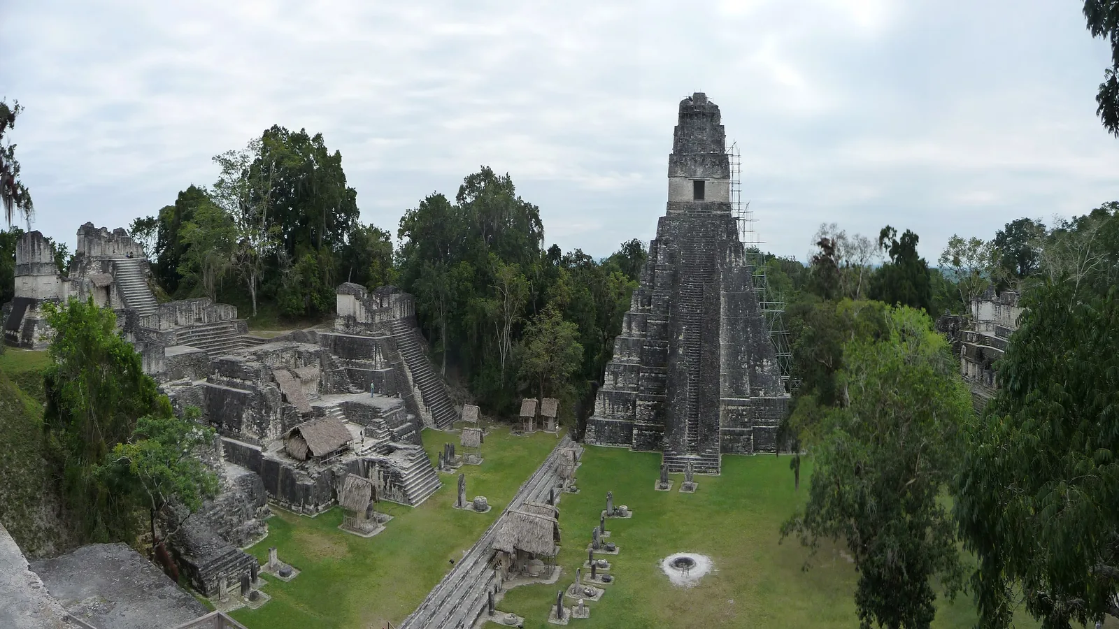

TL;DR — Several causes at once: harsher drought in the south, war at walled cities such as Aguateca, millions of people on the land, while northern Chichén Itzá recovered.
Dated stone monuments in the Southern Lowlands stopped altogether by AD 998. A 2025 Science Advances study led by Daniel H. James of the University of Cambridge writes that in the Terminal Classic Period, about 800 to 1000, the large cities of the Southern Lowlands went through upheaval, abandonment and depopulation as political power shifted north. The same paper states that “singular causes are inconsistent with the considerable spatial and temporal complexity of both archaeological and paleoclimate evidence.” Walls at Aguateca, cores from two lakes, cave stalagmites and lidar maps each answer part of the question, and their authors disagree on how much weight drought should carry.
Quick facts
- When
- about AD 800 to 1000 (Terminal Classic Period) · early ninth century (fall of Aguateca) · AD 700 to 800 (decline in rainfall predictability in southern Belize) · AD 929 to 942 (13-year drought in northwest Yucatán) · about AD 950 (end of Uxmal's political system) · by AD 998 (dated monuments cease)
- Where
- the Southern Lowlands of the Yucatán Peninsula, including Aguateca and the Petén forest in what is now Guatemala; Yok Balum Cave in southern Belize; Grutas Tzabnah, Uxmal and Chichén Itzá in Yucatán, Mexico
- Who
- Takeshi Inomata (Aguateca); Peter M. J. Douglas and colleagues (lake cores); Tobias Braun and colleagues (Yok Balum); Mark Collard, W. Christopher Carleton and David A. Campbell (conflict and climate); Stephen Houston, Marcello A. Canuto and Francisco Estrada-Belli (lidar); Daniel H. James and colleagues (Tzab06-1 stalagmite)
- Outcome
- The large southern cities were abandoned and depopulated and political power moved north. The studies agree on more than one cause and disagree on the weight of drought, on rainfall against temperature, and on the size of the peak population
Aguateca and its defensive walls
Aguateca, in what is now Guatemala, was excavated by the Vanderbilt Petexbatun Archaeological Project from 1989 to 1994. Takeshi Inomata of Yale University set out its sequence in Ancient Mesoamerica in 1997. After a Late Preclassic occupation and little activity in the Early Classic, Aguateca grew quickly into a densely occupied center, probably at the start of the eighth century AD, and Inomata wrote that “Migration from other areas may have contributed to this rapid population growth.”
In the late eighth century the residents built extensive defensive walls, “most likely as a response to intensified warfare.” Enemies still attacked and brought it down, probably at the beginning of the ninth century, and the center “appears to have been almost completely abandoned soon after this event.” Inomata concluded that intensified warfare “played an important role in the Classic Maya collapse.”
Two lake cores, north and south
Peter M. J. Douglas and six co-authors pointed out in PNAS in 2015 that most evidence for drought came from the drier, less populated northern lowlands, while the earlier and sharper breakdown happened in the more humid south. Plant-wax isotopes in cores from Lake Chichancanab in the north and Lake Salpetén in the south showed that “relatively more intense drying occurred in the southern lowlands than in the northern lowlands” during the Terminal Classic.
A decline in C4 plants in both catchments during the Early Classic, after a dry period in the south from about 200 to 500, was read as a shift to intensive, water-conserving maize farming. Those adaptations worked at first, the authors concluded, and “failed under the more severe droughts of the Terminal Classic period.”
A stalagmite from Yok Balum Cave in southern Belize places the trouble earlier. Tobias Braun of the Potsdam Institute for Climate Impact Research and his colleagues reported in 2023 a pronounced fall in the predictability of seasonal rainfall, with severe drought, between AD 700 and 800, when Maya institutions first began to come apart. They proposed that abandonment was “aggravated by year-to-year decreases in rainfall predictability,” and listed rigid political structures, economic dependencies and centuries of population growth alongside climate.
Rainfall or heat in the conflict record
Classic Maya warfare can be counted only where it was carved. Mark Collard of Simon Fraser University and two co-authors traced the dispute in PLOS ONE in 2021. In their account, a 2012 Science paper by Douglas J. Kennett and colleagues set the inscribed record of conflict beside the Yok Balum rainfall record and “found an association between declining rainfall and increased conflict.” A 2017 study by W. Christopher Carleton, a co-author of both later papers, added summer sea-surface temperatures from the Cariaco Basin and found that conflict tracked summer heat. Citing research that maize yields fall by as much as 1% for each day above 30°C, his group proposed that poorer harvests produced “crises of political legitimacy.”
The 2021 paper rebuilt the conflict series year by year, where both earlier studies had used 25-year bins, and concluded that the rise in conflict between the Early and Late Classic was influenced “by growing-season temperature rather than by annual rainfall variation,” and that the binning had misled the 2012 analysis. Because the counts come from monuments, recorded wars fall when monument-making falls, so the authors modeled “conflicts per monument.”
"A 45% jump" in the lidar counts
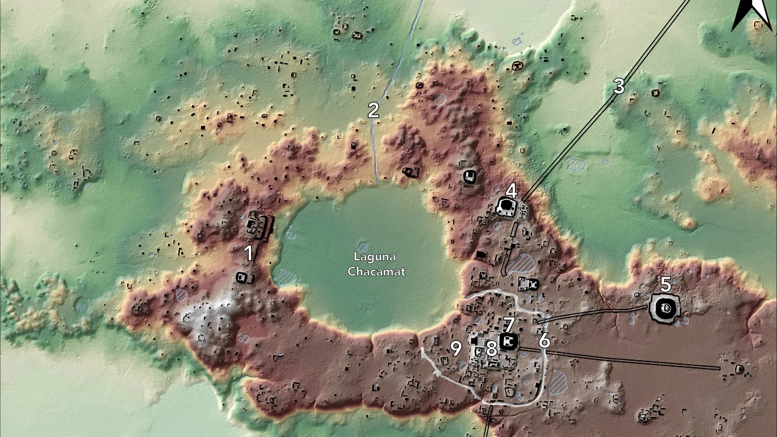
Lidar counts buildings, and population is estimated from them. Stephen Houston of Brown University helped lead a 2016 survey, funded by Guatemala’s Fundación PACUNAM, that scanned 2,100 square kilometers of forest in northern Guatemala from the air. Brown’s release of September 27, 2018, reports more than 64,000 dwellings and structures, an estimated population for the area of about 7 to 11 million, and intensive farmland, roads and fortifications. One set of fortifications, with moated areas and ridge-top cisterns, extended over at least six kilometers. Marcello A. Canuto of Tulane University said in February 2018 that the region was “much more densely populated than what we have traditionally thought.”
In July 2025 a Tulane team led by Francisco Estrada-Belli published a reanalysis in the Journal of Archaeological Science: Reports. It estimated between 9.5 million and 16 million people in the Late Classic period, 600 to 900, across 95,000 square kilometers. Estrada-Belli said that “seeing a 45% jump was truly surprising.” The two estimates cover areas of very different size, and both describe the Late Classic peak. Neither measures how many people left, or when.

AD 929 to 942 in northwest Yucatán
James and his colleagues sampled a stalagmite, Tzab06-1, from Grutas Tzabnah near Tecoh in Yucatán, giving a season-by-season drought record from 871 to 1021, dated to within six years. A drought began in 894 and lasted four years; one wet year followed, then five more dry years. Then came “the longest identified extreme drought, which lasted 13 consecutive years,” from 929 to 942, longer than any multiyear drought in local records from 1500 to 1900, where the longest ran 10 years.
Northern cities answered at different times. Radiocarbon dates at the smaller sites of Labna and Kiuic point to abandonment in the late ninth and early 10th centuries. At Uxmal, hieroglyphic writing peaked between 895 and 907, and estimates for the end of its political system center on 950, eight years after the 13-year drought ended. No run of consecutive wet years came until 986.
Chichén Itzá split in two. “Old Chichén,” built in the Puuc style and dated by radiocarbon between 605 and 845, declined alongside these droughts. “New Chichén,” in the international style, recovered and flourished into the late 900s, possibly trading maize for more durable goods from central Mexico, and controlled a tribute system across central and northern Yucatán. The authors tie that recovery to a gentler climate: between 942 and 1022 the stalagmite holds “only three multiyear droughts,” more than 10 years apart.
Key facts
- Dated monuments in the Southern Lowlands ceased entirely by AD 998, and power shifted north during the Terminal Classic, about 800 to 1000 (James and others, Science Advances, 2025).
- Aguateca built extensive defensive walls in the late eighth century and was attacked and brought down, probably early in the ninth century, then almost completely abandoned (Inomata, Ancient Mesoamerica, 1997).
- Lake Salpetén in the south dried more than Lake Chichancanab in the north during the Terminal Classic (Douglas and others, PNAS, 2015).
- The Yok Balum Cave stalagmite in southern Belize shows a pronounced fall in rainfall predictability and severe drought between AD 700 and 800 (Braun and others, 2023).
- A 2012 study linked conflict to falling rainfall; a 2017 study and a 2021 reanalysis linked it to summer temperature instead (Collard, Carleton and Campbell, PLOS ONE, 2021).
- Lidar over 2,100 square kilometers of northern Guatemala found more than 64,000 structures and an estimated 7 to 11 million people (Brown University, 2018).
- A 2025 reanalysis estimated 9.5 to 16 million people across 95,000 square kilometers in the Late Classic, 600 to 900 (Tulane University, 2025).
- Northwest Yucatán had a 13-year drought from 929 to 942; Uxmal’s political system ended about 950, while New Chichén flourished into the late 900s (James and others, 2025).
FAQ
Did drought cause the Classic Maya collapse?
The lake and cave studies cited here all find drought, and none treats it as the only cause. Douglas and colleagues found harsher drying in the south, where decline came earlier; Braun and colleagues stress unpredictable rainfall together with rigid politics and population growth; James and colleagues show northern cities responding to the same droughts at different times.
How many people lived in the Maya lowlands before the collapse?
Estimates depend on the area surveyed. Brown University reported about 7 to 11 million for 2,100 square kilometers of northern Guatemala in 2018. Tulane University reported 9.5 to 16 million for 95,000 square kilometers in 2025. Both refer to the Late Classic peak.
Why did Chichén Itzá keep growing when southern cities emptied?
James and colleagues suggest that New Chichén controlled a large tribute system, may have traded maize for durable goods from central Mexico, and recovered during a period from 942 to 1022 with only three multiyear droughts.
Sources
- Daniel H. James, Stacy A. Carolin and others, "Classic Maya response to multiyear seasonal droughts in Northwest Yucatán, Mexico," Science Advances 11, no. 33, eadw7661 (August 13, 2025), full text at PubMed Central.
- Peter M. J. Douglas, Mark Pagani, Marcello A. Canuto, Mark Brenner, David A. Hodell, Timothy I. Eglinton and Jason H. Curtis, "Drought, agricultural adaptation, and sociopolitical collapse in the Maya Lowlands," PNAS 112, no. 18 (2015): 5607-5612, first page (California Water Library copy).
- Tobias Braun, Sebastian F. M. Breitenbach and others, "Decline in seasonal predictability potentially destabilized Classic Maya societies," Communications Earth & Environment 4, 82 (2023), full text at PubMed Central.
- Mark Collard, W. Christopher Carleton and David A. Campbell, "Rainfall, temperature, and Classic Maya conflict: A comparison of hypotheses using Bayesian time-series analysis," PLOS ONE 16, no. 7, e0253043 (2021), full text at PubMed Central.
- Takeshi Inomata, "The Last Day of a Fortified Classic Maya Center: Archaeological Investigations at Aguateca, Guatemala," Ancient Mesoamerica 8, no. 2 (1997): 337-351, abstract (Cambridge University Press).
- Brown University, "Lasers reveal a vast, sophisticated Maya civilization under the Guatemalan jungle" (news release with Stephen Houston, September 27, 2018).
- Tulane University, "Tulane researchers central to laser-discovered Maya cities" (news release, February 6, 2018).
- Tulane University, "Ancient Maya population may have topped 16 million, Tulane research shows" (news release, July 29, 2025).
Cite this article
- APA
- Song Letter. (2026, November 2). Why did the Classic Maya cities empty? Lake cores, a stalagmite, lidar. Our Earth's History. https://ourearthshistory.com/americas/medieval/why-did-the-classic-maya-cities-empty-drought-lidar/
- Chicago
- Song Letter. “Why did the Classic Maya cities empty? Lake cores, a stalagmite, lidar.” Our Earth's History, November 2, 2026. https://ourearthshistory.com/americas/medieval/why-did-the-classic-maya-cities-empty-drought-lidar/.
- MLA
- Song Letter. “Why did the Classic Maya cities empty? Lake cores, a stalagmite, lidar.” Our Earth's History, 2 Nov. 2026, https://ourearthshistory.com/americas/medieval/why-did-the-classic-maya-cities-empty-drought-lidar/.
Get the week in history
One email a week: the new articles, and what was happening elsewhere at the same moment. Free, no ads, unsubscribe any time. How we handle your email.
Text licensed CC BY-NC-ND 4.0. Found an error? Tell us.