Joya de Cerén: a Maya farming village sealed by Loma Caldera ash

TL;DR — Ash from the Loma Caldera vent buried Joya de Cerén, a Maya village in El Salvador, in the seventh century AD; digs found stocked houses and no bodies.
A tractor driver leveling a low hill in the Zapotitán valley of El Salvador in 1976, to make a platform for grain silos, saw his blade cut the corner of a building buried under volcanic ash. He telephoned the National Museum of Anthropology in San Salvador. The building belonged to a Maya farming village that ash from the Loma Caldera vent had covered in the seventh century AD. From 1978 the archaeologist Payson Sheets of the University of Colorado excavated houses left with their tools, food and valuables in place, and fields harvested shortly before the eruption. His teams found no human remains.
Quick facts
- When
- seventh century AD (eruption; about AD 630 in University of Colorado reports, about AD 650 according to El Salvador's Ministry of Culture) · 1976 (bulldozer discovery) · 1978 (Sheets' first season and radiocarbon dates) · 1981-1988 (no fieldwork during the civil war) · 2007 and 2009 (manioc fields) · July 2011 (white road found)
- Where
- Joya de Cerén, Zapotitán valley, department of La Libertad, El Salvador; the Loma Caldera vent lay about 600 meters north-northwest of the village
- Who
- the villagers of Cerén; an unnamed tractor driver; the National Museum of Anthropology in San Salvador; Payson Sheets and his University of Colorado teams; radiocarbon specialist Sam Valastro; Christine Dixon
- Outcome
- Twelve buildings excavated by 2011, with tools, food and valuables left in place; manioc fields harvested shortly before the eruption; no human remains found at the village
Silos, a tractor blade and a museum verdict
The museum took three days to send someone, Sheets wrote in his 2013 book. The visitor saw how well the building was preserved, concluded that it was very recent and unimportant, and let the tractor carry on. Two groups of buildings near the house now called Structure 1 were destroyed completely.
Two years later Sheets was surveying the valley with a student team. Residents, not museum staff, told him about the find. He collected thatch from the collapsed roofs, since thatch had to be replaced about every five years and would be close in age to the burial, and sent it to Sam Valastro at the University of Texas radiocarbon laboratory. Every sample came back at about 1,400 years. “When the radiocarbon dates on the thatched roofs came back in 1978, I saw the rest of my professional life,” Sheets told the university’s news office in 2011. After survey seasons in 1979 and 1980, the Salvadoran civil war kept the team away until 1989.
Loma Caldera and the Rio Sucio
The vent opened 600 meters north-northwest of the village, according to the 2011 field report Sheets edited with Christine Dixon. The eruption began as a steam explosion when rising magma met water from the Rio Sucio. Fourteen layers of ash and cinders built up, alternating between wet and dry phases. The wet layers arrived moist at about 100 degrees Celsius and coated maize stalks, which later rotted and left hollow molds for excavators to fill with dental plaster. In the dry phases, cinders larger than a hen’s egg landed at more than 575 degrees.
The year is less exact than the season. The Colorado report puts the burial “in about AD 630,” and the university’s 2011 news release gave the radiocarbon result as “roughly A.D. 630.” El Salvador’s Ministry of Culture dates it “aproximadamente para el 650 d.C.,” about AD 650. Sheets placed the eruption at about 7 p.m. on an August evening. Maize stalks preserved in the casts were mature, farm tools had been brought indoors, sleeping mats had not been unrolled, dishes were unwashed, and maize had been set in pots to soak overnight.
Loma Caldera was a separate event from the eruption of Ilopango volcano, whose white ash lies under the village; Cerén’s builders dug through it to reach soil for their house platforms. A 2019 study in Quaternary Science Reviews dated the Ilopango eruption to AD 539 or 540.
Inside the households
El Salvador’s Ministry of Culture calls the site “la Pompeya de América.” The university’s 2011 release, describing Sheets’ view, drew the contrast: Pompeii was an affluent Roman resort with multistory concrete houses and marble statues, “while Ceren was a modest farming community.” By then the teams had excavated 12 buildings, among them living quarters, storehouses, kitchens and a community sauna, in a village estimated at about 200 people.
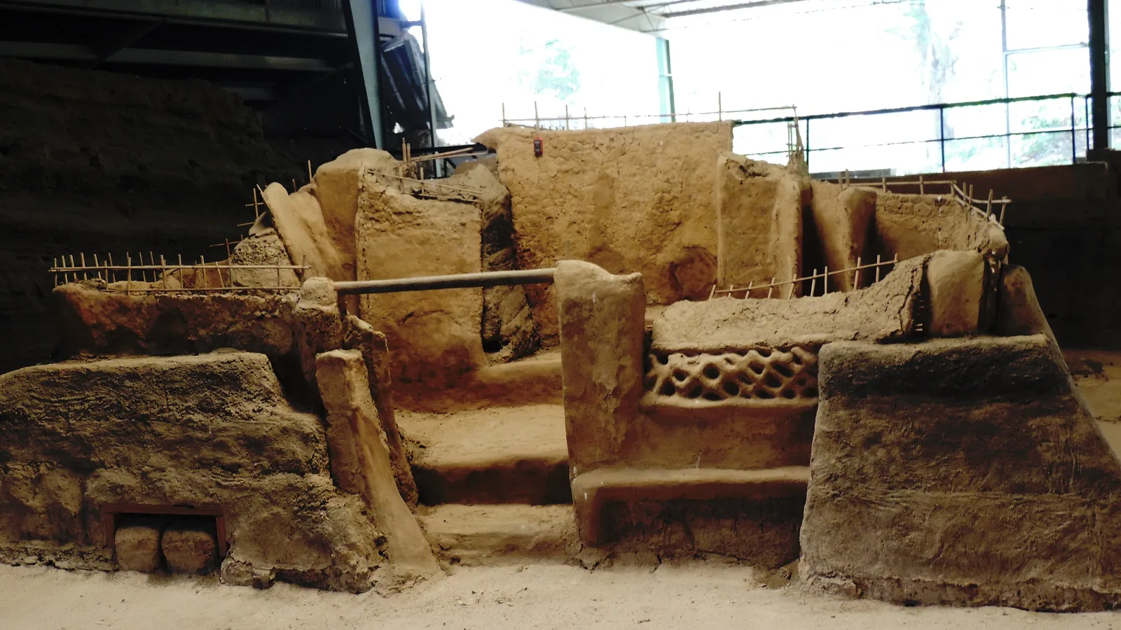
In Sheets’ plan of Household 1, Structure 1 was the domicile, where the family ate, slept, made pottery and cotton thread, and kept some tools and food. Structure 5 was the man’s workplace, Structure 6 the storehouse and Structure 11 the kitchen. South of the storehouse lay a kitchen garden of six parallel rows, planted with manioc, malanga and cebadilla, a medicinal plant still used in Central America for stomach complaints.
Each household produced at least one good in surplus for exchange, in Sheets’ reading. Household 1 made grinding stones, and every spindle whorl found at the site by 2013 came from it. Household 2 made painted gourds and kept the sauna, Structure 9, supplied with water and firewood.
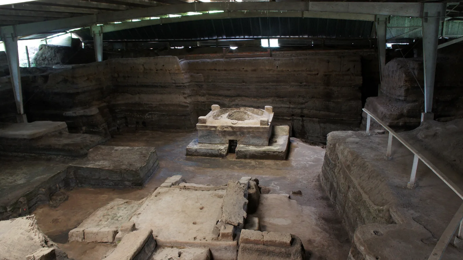
Both excavated storehouses were full of pottery vessels holding seeds. In the Household 2 storehouse, new obsidian blades had been tucked into the thatch, and a group of valuables sat in the back right corner: five miniature vessels, jade beads, a shell pendant and a bone figurine. One of two ceremonial buildings excavated in 1991 held the bones of butchered deer and a deer headdress painted red and blue, which Sheets took as signs of a harvest ceremony under way when the eruption began.

Harvested about a week before the ash
In 2007 the team dug six test pits on private land south of the archaeological park and found an area of intensive manioc cultivation. In 2009, about 200 meters south of the village, they exposed three manioc fields of large sloping raised beds, shaped in three styles that the report attributed to three different farmers. The beds had already been harvested. The report estimated the yield at more than 10 metric tons of tubers and argued from the rough surface of the beds, which the rains would have smoothed within a couple of weeks, that the harvest came a few weeks at most before the eruption. A 2012 paper in Latin American Antiquity by Sheets and six co-authors put it at about a week.
That paper revised an older reading. Manioc plants found in the kitchen gardens in the 1990s had been taken to mean that the crop added to the diet without being a staple. After the fields outside the village, the authors concluded: “At Cerén manioc was a staple.”
Where the villagers went
No human remains had been found at the village, the university reported in 2011. People who watched the bulldozer in 1976 later spoke of remains under the floor of Structure 1; Sheets judged those accounts unreliable, a rural version of an urban legend. In his book he suggested that warning signs before the first ash unit may have given people time to leave, or that they escaped in a pause between the first and second units. Because they left to save their lives, he wrote, they carried very little and left nearly complete inventories of their belongings.
In July 2011 a test pit dug through 17 feet of ash struck a road about 6 feet wide, built of white ash from an earlier eruption packed down and shored up along its edges. Two further pits traced it for at least 148 feet toward the ceremonial buildings. Roads of this kind, called sacbe, had been known from the Yucatán with stone linings; Sheets said this was the first found at a Maya site built without bordering paving stones.
Sheets gave his own reading of that evening in October 2011. “We’ve found no evidence of anyone going back to their houses, gathering up valuables, and fleeing, because all the household doors were tied shut,” he said. “We think people may have left the plaza and run south, possibly on the sacbe, because the danger was to the north.”
Key facts
- In 1976 a tractor driver leveling a hill for grain silos cut into a buried building; a museum visitor, three days later, judged it recent, and the work went on (Sheets 2013).
- In 1978 thatch samples dated at the University of Texas all came back at about 1,400 years (Sheets 2013).
- The Salvadoran civil war stopped fieldwork after 1980; excavation resumed in 1989 (Sheets 2013).
- The Loma Caldera vent lay about 600 meters north-northwest of the village and began with a steam explosion where magma met the Rio Sucio (Sheets and Dixon 2011).
- University of Colorado sources date the burial to about AD 630; El Salvador’s Ministry of Culture gives about AD 650.
- By 2011, 12 buildings had been excavated in a village estimated at about 200 people (CU Boulder Today, 2011).
- Manioc fields south of the village, found in 2007 and 2009, yielded an estimated 10 metric tons of tubers harvested shortly before the eruption (Sheets and Dixon 2011; Sheets and others 2012).
- A white road about 6 feet wide, built without stone borders, was found in July 2011; no human remains had been found at the village (CU Boulder Today, 2011).
FAQ
When did the Loma Caldera eruption bury Joya de Cerén?
In the seventh century AD. University of Colorado reports led by Payson Sheets give about AD 630, while El Salvador's Ministry of Culture gives about AD 650. Sheets placed it at about 7 p.m. on an August evening, from the state of crops and household objects.
Were any bodies found at Joya de Cerén?
No human remains had been found at the village as of the 2011 and 2013 reports. Sheets judged local accounts of bones under Structure 1 unreliable and suggested that the villagers fled, possibly south along the white road.
Is Joya de Cerén the same eruption as Ilopango?
No. The Ilopango eruption came earlier, and its white ash lies beneath the village. A 2019 study dated it to AD 539 or 540. The Loma Caldera vent that buried Cerén opened about 600 meters from the village.
Sources
- University of Colorado Boulder, CU Boulder Today, "CU-Boulder team discovers ancient road at Maya village buried by volcanic ash 1,400 years ago" (October 5, 2011) — used for the sacbe, the August 7 p.m. estimate, the tied doors, the building count and population, the Pompeii comparison, and Sheets' quoted statements.
- Payson Sheets and Christine Dixon (eds.), Maya Agriculture South of the Ceren Site, El Salvador, 2011 (University of Colorado Boulder, Department of Anthropology, field report) — used for the vent location, the steam explosion, the tephra layers and temperatures, the AD 630 date, and the 2007, 2009 and 2011 field results.
- Payson Sheets, Joya de Cerén: Patrimonio Cultural de la Humanidad, 1993-2013 (San Salvador: Editorial Universitaria, Universidad de El Salvador, 2013) — used for the 1976 discovery, the museum visit, the 1978 dating, the civil-war gap, Household 1, the storehouses, household crafts, the sauna and the abandonment.
- Payson Sheets, David Lentz, Dolores Piperno, John Jones, Christine Dixon, George Maloof and Angela Hood, "Ancient Manioc Agriculture South of the Ceren Village, El Salvador," Latin American Antiquity 23, no. 3 (2012): 259-281 (abstract, Cambridge University Press).
- R. A. Dull, J. R. Southon, S. Kutterolf and others, including P. Sheets, "Radiocarbon and geologic evidence reveal Ilopango volcano as source of the colossal 'mystery' eruption of 539/40 CE," Quaternary Science Reviews 222 (2019), 105855 (U.S. Geological Survey publications record and abstract).
- Ministerio de Cultura de El Salvador, "Parque Arqueológico Joya de Cerén" (archived copy of November 4, 2023, Internet Archive) — used for the AD 650 date, the World Heritage inscription date and the park's location.
Cite this article
- APA
- LETTER. (2026, September 28). Joya de Cerén: a Maya farming village sealed by Loma Caldera ash. Our Earth's History. https://ourearthshistory.com/americas/classical/joya-de-ceren-maya-village-loma-caldera-ash-1976-bulldozer/
- Chicago
- LETTER. “Joya de Cerén: a Maya farming village sealed by Loma Caldera ash.” Our Earth's History, September 28, 2026. https://ourearthshistory.com/americas/classical/joya-de-ceren-maya-village-loma-caldera-ash-1976-bulldozer/.
- MLA
- LETTER. “Joya de Cerén: a Maya farming village sealed by Loma Caldera ash.” Our Earth's History, 28 Sep. 2026, https://ourearthshistory.com/americas/classical/joya-de-ceren-maya-village-loma-caldera-ash-1976-bulldozer/.
Text licensed CC BY-NC-ND 4.0. Found an error? Tell us.