How did Polynesians find Hawaii and New Zealand without a compass?

TL;DR — Pacific navigators read star rising points, swells, clouds and birds, and counted distance run in their heads. Hokulea crossed to Tahiti that way in 1976.
Polynesian navigators found Hawaii and New Zealand by reading the rising and setting points of stars, the set of the ocean swells, cloud shapes and seabird flights. They carried no compass, chart or timekeeper, and sailed double-hulled canoes that could work to windward. Radiocarbon dates published in 2011 put the settlement of the Society Islands at about AD 1025 to 1120 and the rest of East Polynesia, Hawaii and New Zealand included, at about AD 1190 to 1290. For most of the twentieth century a school of writers held that the islands were reached by accident; a canoe launched in Hawaii in 1975 answered them in public.
Quick facts
- When
- Society Islands settled about AD 1025–1120, the rest of East Polynesia about AD 1190–1290; Hokulea sailed to Tahiti in 1976
- Where
- The Pacific between Hawaii, Tahiti, Aotearoa (New Zealand), Rapa Nui, Satawal and the Marshall Islands
- Who
- Mau Piailug of Satawal, Nainoa Thompson, Ben Finney, David Lewis, Andrew Sharp, Janet Wilmshurst and colleagues
- Outcome
- Radiocarbon dating placed the settlement in two short phases; non-instrument voyaging was relearned from Micronesia after 1976 and is taught today
The star compass and its 32 houses
The Polynesian Voyaging Society describes the Hawaiian star compass, worked out by Nainoa Thompson, as a mental division of the visible horizon into 32 houses of 11.25 degrees each. East is Hikina, “to arrive,” where celestial bodies come up; west is Komohana, “to enter.” The houses carry names running outward from east and west: Lā the sun, ʻĀina land, Noio tern, Manu bird, Nālani heavens, Nāleo voices, Haka empty.
A star rises in one house and sets in the house of the same name opposite, so a navigator holds a heading all night by swapping one star for the next as each climbs too high to use. The Exploring Our Fluid Earth course at the University of Hawaiʻi at Mānoa states that master navigators memorize the rising and setting points of hundreds of stars, in eight families across the 32 houses.
Swells, clouds, birds and the running count
Cloud hides the stars for days at a time, so the swells carry more of the work. Swells are waves that have outrun the wind that raised them, and they hold their direction. The text of The Mariners’ Museum exhibition, reprinted by NOAA’s Mariners Weather Log in 2008, records that swells are more easily felt than seen, which is why a navigator lies down in the hull. Islands block, reflect and refract them, and the Mānoa course describes how reading that pattern places a low island still below the horizon.
Land also announces itself in the sky. The same text records that cloud gathers over an island in a V shape from the heat rising off it, and that a green tint in the cloud base means a lagoon below, bright cloud sand and dark cloud forest. Fairy terns and noddy terns nest ashore and cannot swim; they fly out at dawn and back at dusk, with ranges the museum gives as about 120 miles and about 40.
Under all of it runs dead reckoning, the running estimate of speed and time that fixes how far the canoe has come. The Voyaging Society sets out a three-part strategy today: aim upwind of the target, hold that reference course while counting distance and direction run, then search a box of ocean where the island should be. In the Marshall Islands that knowledge was modeled ashore in charts of lashed sticks and cowry shells. Adrienne Kaeppler of the National Museum of Natural History told Smithsonian Magazine that the charts were studied on land and left behind at sailing time.
The canoes
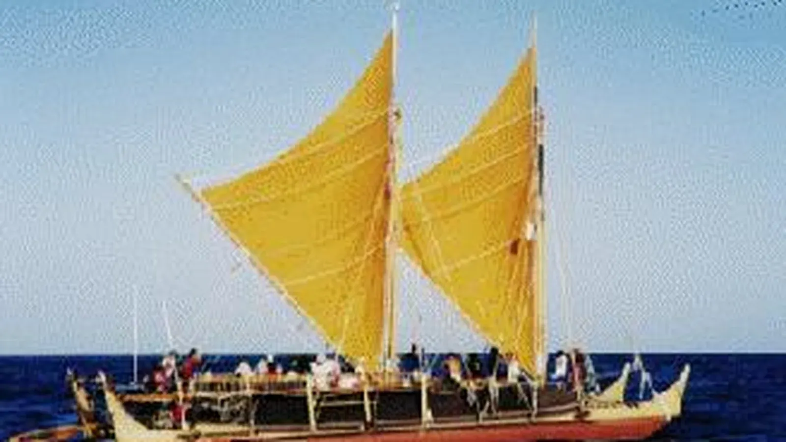
The canoe was a waʻa kaulua, a double hull with two masts. Hōkūleʻa, launched at Kualoa on Oʻahu on March 8, 1975, measures 62 feet long and 19 feet across. Ben Finney wrote that she carried two Polynesian sprit sails, made 10 knots or better on a broad reach and held 4 or 5 knots to windward. A hull that can only run downwind cannot search, and cannot come home.
The drift argument, 1956
In 1956 Andrew Sharp, a New Zealand civil servant turned historian, published Ancient Voyagers in the Pacific with the Polynesian Society in Wellington. Sharp accepted that the settlers came from the west and argued that they arrived by accident, as survivors of canoes blown off course or driven out by war and famine. The canoes were not seaworthy enough for planned voyages, he wrote, and the navigation not accurate enough; he capped an intentionally navigated round trip at 300 nautical miles.
Three answers followed. David Lewis sailed his catamaran from Tahiti to New Zealand without instruments in the mid-1960s, then published We, the Navigators in 1972 on Micronesian and Polynesian navigation. Michael Levison, R. Gerard Ward and John W. Webb simulated drift voyages by computer under recorded Pacific winds and currents in The Settlement of Polynesia (1973); Finney wrote that it showed how unlikely a drift crossing to Hawaii, Rapa Nui or Aotearoa would have been. Finney measured what a 40-foot replica Hawaiian double canoe could do, then proposed the 2,250-mile run to Tahiti as a test of Sharp’s ceiling.
The 1976 voyage to Tahiti
By 1973, when Finney, Herb Kawainui Kāne and Tommy Holmes founded the Polynesian Voyaging Society, no navigator in Hawaii still held the old knowledge. The society found Mau Piailug of Satawal in Micronesia, who agreed to take the canoe to Tahiti. Hōkūleʻa left Honolua Bay on Maui on May 1, 1976, and Piailug brought her into Papeʻete Harbor 33 days later, to a crowd the Bishop Museum puts above 17,000. The Mānoa course describes the voyage as evidence for purposeful navigation and a source of cultural inspiration.
Piailug returned in 1979 to train Nainoa Thompson, and sailed both legs of the 1980 voyage in support. Thompson navigated Hōkūleʻa to Tahiti and back that year, a return the Voyaging Society records as the first in 600 years, then navigated the 1985 to 1987 voyage to Aotearoa and began training Pacific navigators in 1992.
What the dates left open
Janet Wilmshurst, Terry Hunt, Carl Lipo and Atholl Anderson reached their chronology by throwing dates away. Their 2011 analysis in the Proceedings of the National Academy of Sciences sorted 1,434 radiocarbon dates and kept only short-lived samples, discarding unidentified charcoal and marine shell for their large built-in errors. What remained was settlement of the Society Islands about AD 1025 to 1120, a gap of 70 to 265 years, then one pulse reaching every remaining archipelago between about AD 1190 and 1290.
Whether the same canoes went as far as South America is unsettled. The Smithsonian Science Education Center, writing on the 2020 Nature study by Andres Ioannidis and colleagues, reports South American ancestry appearing in the South Marquesas around AD 1200 and reaching Rapa Nui about 200 years later, and states that the direction of travel and the sweet potato’s arrival are open questions.
Key facts
- The Hawaiian star compass divides the horizon into 32 houses of 11.25 degrees; master navigators memorize the rising and setting points of hundreds of stars (Polynesian Voyaging Society; University of Hawaiʻi at Mānoa).
- Swells hold direction for days and are felt through the hull; islands block, reflect and refract them, which reveals land below the horizon.
- Cloud shape and color and the daily flights of fairy and noddy terns gave direction and rough distance to land (The Mariners’ Museum, reprinted by NOAA in 2008).
- Marshall Islands stick charts modeled swell patterns with sticks and cowry shells and were studied ashore rather than carried to sea (Adrienne Kaeppler, National Museum of Natural History).
- Wilmshurst and colleagues (2011) dated the Society Islands to about AD 1025–1120 and the rest of East Polynesia to about AD 1190–1290, from 1,434 radiocarbon dates.
- Andrew Sharp argued in 1956 that settlement was accidental and capped intentional round trips at 300 nautical miles; Lewis, Levison, Ward, Webb and Finney answered in the 1960s and early 1970s.
- Hōkūleʻa, 62 feet long, sailed from Maui on May 1, 1976, and reached Papeʻete 33 days later under Mau Piailug of Satawal.
FAQ
How did Polynesian navigators steer at night without a compass?
By the star compass: the horizon divided into 32 named houses of 11.25 degrees, with each star rising in one house and setting in the house of the same name opposite. As one star climbed too high, the navigator picked up the next star in the same house.
Were Hawaii and New Zealand reached by accident?
Michael Levison, R. Gerard Ward and John W. Webb simulated drift voyages under recorded winds and currents in 1973 and found the eastern crossings improbable as drift. David Lewis and Ben Finney showed by sailing that non-instrument navigation and double-hulled canoes could do the work.
Who navigated Hokulea to Tahiti in 1976?
Mau Piailug, a navigator from Satawal in Micronesia, the only traditional navigator willing to teach outside his own culture, according to the Polynesian Voyaging Society. He returned in 1979 to train Nainoa Thompson and sailed both legs of the 1980 voyage in support.
Sources
- Polynesian Voyaging Society — "Polynesian Wayfinding: Modern Methods and Techniques of Non-Instrument Navigation."
- Polynesian Voyaging Society — "History: The Story of Hokulea."
- Polynesian Voyaging Society archive — Ben Finney, "The Founding of the Polynesian Voyaging Society," first published in From Sea to Space (Massey University, 1992).
- Polynesian Voyaging Society archive — Ben Finney, "Voyaging into Polynesia's Past: References."
- Bishop Museum — "Hokulea," Pacific Hall exhibition text.
- University of Hawaii at Manoa — "Wayfinding and Navigation," Exploring Our Fluid Earth.
- NOAA, Mariners Weather Log 52:2 (August 2008) — "Tools of Navigation," reprinted from The Mariners' Museum, Newport News.
- Smithsonian Magazine — "How Sticks and Shell Charts Became a Sophisticated System for Navigation."
- PNAS 108(5) via PubMed Central — Wilmshurst, Hunt, Lipo and Anderson, "High-precision radiocarbon dating shows recent and rapid initial human colonization of East Polynesia" (2011).
- Smithsonian Science Education Center — "From Sweet Potatoes to DNA: New Evidence Supports Links Between South American and Polynesian Cultures."
Cite this article
- APA
- Our Earth's History. (2026, September 19). How did Polynesians find Hawaii and New Zealand without a compass? Our Earth's History. https://ourearthshistory.com/oceania/medieval/polynesian-wayfinding-without-instruments/
- Chicago
- Our Earth's History. “How did Polynesians find Hawaii and New Zealand without a compass?” Our Earth's History, September 19, 2026. https://ourearthshistory.com/oceania/medieval/polynesian-wayfinding-without-instruments/.
- MLA
- “How did Polynesians find Hawaii and New Zealand without a compass?” Our Earth's History, 19 Sep. 2026, https://ourearthshistory.com/oceania/medieval/polynesian-wayfinding-without-instruments/.
Text licensed CC BY-NC-ND 4.0. Found an error? Tell us.