Sand, reef and stick charts: settling the Marshall Islands
.jpg)
TL;DR — A 2022 PNAS study ties atoll settlement to sea-level fall after a mid-Holocene highstand. Digs date Ebon’s occupation to two millennia and Utrōk’s to the first centuries AD.
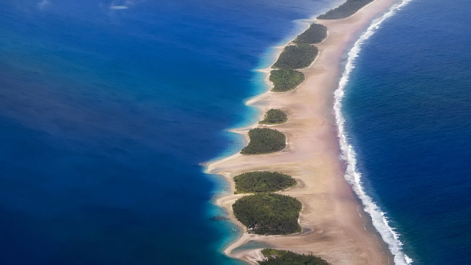
Atolls “were settled during a later, secondary migration . . . because they are less desirable for settlement than high islands,” Juliet Sefton and six coauthors wrote in a 2022 PNAS study. That secondary settlement of low equatorial atolls came about 2,000 years before the present, roughly 1,000 years after the first Lapita voyagers reached the high islands of Remote Oceania. In the Marshall Islands, a chain of coral atolls in eastern Micronesia, excavations at two atolls, Ebon and Utrōk, have produced their own dates for human occupation.
Quick facts
- When
- About 2,000 years before the present, a secondary migration pulse that settled low equatorial atolls roughly 1,000 years after the first high-island landfalls in Remote Oceania (Sefton et al., PNAS, 2022); occupation at Utrōk atoll indicated by the first few centuries AD (Weisler, 2001); two millennia of continuous occupation documented at Ebon atoll (Lambrides, 2017; Lambrides and Weisler, 2018)
- Where
- Ebon and Utrōk atolls in the Marshall Islands, eastern Micronesia
- Who
- Archaeologist Marshall I. Weisler of the University of Queensland; his doctoral student Ariana B. J. Lambrides; the PNAS team of Juliet P. Sefton, Andrew C. Kemp and colleagues; navigator and anthropologist Joseph Genz; Smithsonian curator Adrienne Kaeppler
- Outcome
- Radiocarbon dating shows continuous human occupation of Ebon and Utrōk atolls for about two millennia, tied to atoll exposure after mid-Holocene sea-level fall; Marshallese navigators recorded their knowledge of swells and islands in stick charts called mattang, medo and rebbelib
Sefton and colleagues on why atolls came late
The PNAS paper explains the delay in practical terms. High islands had far better access to fresh water than atolls, the authors wrote, while atolls had “poor-quality coralline soils for agriculture, limited building material (in amount and variety), and are vulnerable to storm surges compared with high islands.” An atoll cannot be settled until its land surface exists above the sea, and the paper’s model shows a mid-Holocene highstand kept many atolls submerged or too small to occupy until relative sea level fell. Sefton and coauthors write that “Pohnpei and Kosrae appear to have been settled at the same time as the atolls between the Southern and Northern Hemisphere migration routes in a secondary pulse of migration within Remote Oceania at ~2,000 y B.P.” That sentence describes a regional pattern across equatorial Micronesia, not a verified date for any single Marshallese site.
Ebon atoll, two millennia of continuous occupation
The individual dates for the Marshall Islands come from fieldwork, not the regional model. Ariana Lambrides, in a 2017 doctoral thesis supervised by Marshall Weisler at the University of Queensland, examined the marine fishery of Ebon atoll “from initial settlement to the historic period,” a span her thesis calls “two millennia of continuous occupation.” Ebon’s reef area, she noted, is four times the size of its dry land, and her survey across the atoll’s islets found that differences in the fish bones between sites reflected fishing technique and site function rather than the surrounding marine environment. A 2018 paper she coauthored with Weisler in Archaeology in Oceania drew on four excavated sites and 4,476 minimum individual mollusks to argue that “human foraging over 2000 years documented no observable human impacts to molluscs or nearshore intertidal marine ecosystems, challenging previous notions of atolls as marginal, exceptionally difficult settings for human habitation.”
Utrōk atoll, dated to the first centuries AD
Farther north, Weisler’s own 2001 study of Utrōk atoll, near the northern limit of permanently inhabited atolls in the Marshall Islands, rests on an intensive survey and 64 square meters of excavation. “A suite of 16 radiocarbon age determinations suggests human occupation of the atoll by the first few centuries AD,” he reported. Utrōk’s largest islet held a 25-hectare habitation and horticultural system, while smaller islets carried only temporary camps. Excavators recovered 173 prehistoric tools and ornaments, including 39 shell adzes, pumice abraders, pearl-shell scrapers, a trolling-lure point, Conus shell rings, Spondylus beads and disks, and a drilled whale tooth. Of 13,545 animal bones recovered, 88.6 percent were fish, alongside dog, Pacific rat, sea turtle, lizard, seabirds and the remains of three people. Weisler also found that the bullmouth helmet shell, Cypraecassis rufa, disappeared locally through human predation, though he judged the broader marine ecosystem to show little effect from the atoll’s small population, while the land itself was, in his words, “markedly altered.”
"These maps consist of small sticks": the West's first account
The missionary L. H. Gulick gave Western readers their first account of Marshallese stick charts in an 1862 issue of Nautical Magazine, quoted in a 2015 Smithsonian Magazine article by Cari Romm: “[The Marshallese] construct rude maps by which they retain and impart knowledge regarding the direction and distance of the various groups . . . These maps consist of small sticks tied together in straight or curved lines, intended to represent the currents or waves to be met, while the islands are to be found at certain points where these lines meet.” In 1899 Charles Townsend and H. F. Moore, scientists with the U.S. Fish Commission traveling aboard the steamer Albatross, bought one such chart with funds the Smithsonian had provided and gave it to the National Museum of Natural History in 1900. Smithsonian curator Adrienne Kaeppler, interviewed for the same article, explained its elements: “Curved sticks . . . show where swells are deflected by an island; short, straight strips often indicate currents near islands; longer strips ‘may indicate the direction in which certain islands are to be found;’ and small cowry shells represent the islands themselves.” Romm’s article adds that the Marshallese “built this essential knowledge by studying the charts on land,” so a sailor had absorbed the lessons before he ever put to sea; the chart was, in her words, “an instructional tool, one meant for use before a voyage, rather than something to be used for real-time navigation.”


Three kinds of chart, described again in 2025
Marshallese navigators recorded that knowledge in three related kinds of object. A 2025 paper in the Journal of Maritime Archaeology by Helen Farr, Benoit Berard, Joseph Genz, Justin Leidwanger and Emma Slayton describes how “Marshallese navigators developed ‘stick charts’ (mattang or wapepe) that abstractly model the conceptual framework underlying wave navigation, including Indigenous concepts that partly resonate with Western oceanographic understandings of wave reflection, refraction and diffraction.” Beyond that training device, the same authors describe “regional cartographies (medo)” that mapped real atoll positions and ocean conditions, and “maps of an entire island chain or the entire archipelago (rebbelib).” One chart illustrated in the paper is a meddo built in 2016 by Isocker Anwell, following a 1902 diagram of a chart the missionary Gulick had collected around 1900 and the Bernice Pauahi Bishop Museum in Honolulu later acquired. Genz first tested this navigational knowledge against modern oceanography in 2005, using satellite imagery, computer modeling and ocean buoys. The 2025 paper describes mattang, medo and rebbelib as “material representations of the navigator’s embodied knowledge of the sea.”
Key facts
- Sefton, Kemp and colleagues place the settlement of low equatorial Pacific atolls, as a regional pattern, at about 2,000 years before the present, roughly 1,000 years after the first high-island landfalls in Remote Oceania (PNAS, 2022).
- Ariana Lambrides’s 2017 doctoral thesis, supervised by Marshall Weisler at the University of Queensland, documents “two millennia of continuous occupation” at Ebon atoll.
- Ebon atoll’s reef area is four times the size of its dry land, according to Lambrides’s thesis.
- A 2018 study by Lambrides and Weisler examined 4,476 minimum individual mollusks from four Ebon atoll sites and found no observable human impact on nearshore ecosystems over 2,000 years.
- Weisler’s 2001 study of Utrōk atoll reports 16 radiocarbon determinations indicating occupation by the first few centuries AD, with a 25-hectare habitation and horticultural system on its largest islet.
- Excavators at Utrōk recovered 173 prehistoric tools and ornaments and 13,545 animal bones, 88.6 percent of them fish.
- The bullmouth helmet shell, Cypraecassis rufa, was extirpated at Utrōk through human predation, while the atoll’s land surface was markedly altered, Weisler wrote.
- A 2025 Journal of Maritime Archaeology paper by Farr, Berard, Genz, Leidwanger and Slayton distinguishes three Marshallese stick chart types: mattang or wapepe (conceptual wave models), medo (regional charts) and rebbelib (charts of the whole archipelago).
FAQ
When were the Marshall Islands first settled?
Sefton and coauthors place the settlement of low equatorial atolls generally, a category that includes the Marshall Islands, at about 2,000 years before the present. Individual excavated sites give their own ranges: Weisler's 2001 study indicates occupation at Utrōk atoll by the first few centuries AD, and Lambrides's 2017 thesis documents two millennia of continuous occupation at Ebon atoll.
What are Marshallese stick charts used for?
Farr, Berard, Genz, Leidwanger and Slayton describe three types built from sticks, fiber and shells: mattang or wapepe, which modeled the conceptual behavior of ocean swells around islands; medo, regional charts of real atoll positions; and rebbelib, charts covering an entire island chain. Cari Romm's 2015 Smithsonian Magazine article, citing curator Adrienne Kaeppler, describes them as instructional tools studied on land before a voyage rather than instruments used at sea.
Why did atolls take longer to settle than high islands in the Pacific?
Sefton and coauthors write that atolls had poor access to freshwater, poor-quality coralline soils, limited building material and vulnerability to storm surges compared with high islands, and that atoll land itself was not exposed for settlement until relative sea level fell from a mid-Holocene highstand.
Sources
- Juliet P. Sefton, Andrew C. Kemp, Simon E. Engelhart, Joanna C. Ellison, Makan A. Karegar, Blair Charley and Mark D. McCoy, "Implications of anomalous relative sea-level rise for the peopling of Remote Oceania," Proceedings of the National Academy of Sciences 119, no. 52 (2022): e2210863119.
- Ariana B. J. Lambrides, "Sustained prehistoric exploitation of a Marshall Islands fishery: ichthyoarchaeological approaches, marine resource use, and human-environment interactions on Ebon Atoll" (PhD thesis, University of Queensland, 2017).
- Ariana B. J. Lambrides and Marshall I. Weisler, "Two millennia of mollusc foraging on Ebon Atoll, Marshall Islands: Sustained marine resource use on a Pacific atoll," Archaeology in Oceania 53, no. 1 (2018).
- Marshall I. Weisler, "Life on the edge: prehistoric settlement and economy on Utrōk Atoll, northern Marshall Islands," Archaeology in Oceania 36, no. 3 (2001): 109-133.
- Helen Farr, Benoit Berard, Joseph Genz, Justin Leidwanger and Emma Slayton, "Navigating the Narrative: Integrating Traditional Knowledge and Embodied Practice within Computational Models of Ancient Seafaring," Journal of Maritime Archaeology 20, no. 3 (2025): 579.
- Cari Romm, "How Sticks and Shell Charts Became a Sophisticated System for Navigation," Smithsonian Magazine, January 26, 2015.
Cite this article
- APA
- LETTER. (2026, September 28). Sand, reef and stick charts: settling the Marshall Islands. Our Earth's History. https://ourearthshistory.com/oceania/classical/marshall-islands-first-settlement-atolls-weisler-stick-charts/
- Chicago
- LETTER. “Sand, reef and stick charts: settling the Marshall Islands.” Our Earth's History, September 28, 2026. https://ourearthshistory.com/oceania/classical/marshall-islands-first-settlement-atolls-weisler-stick-charts/.
- MLA
- LETTER. “Sand, reef and stick charts: settling the Marshall Islands.” Our Earth's History, 28 Sep. 2026, https://ourearthshistory.com/oceania/classical/marshall-islands-first-settlement-atolls-weisler-stick-charts/.
Text licensed CC BY-NC-ND 4.0. Found an error? Tell us.