Three dark bands in a dune: Sigatoka's Levels 1, 2 and 3, dug in 1965
.jpg)
TL;DR — Birks dug three buried soils out of Fiji’s Sigatoka dunes in 1965 and 1966; the middle one, Level 2, was occupied 1,700 to 1,300 years before present.
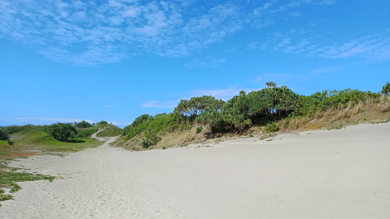
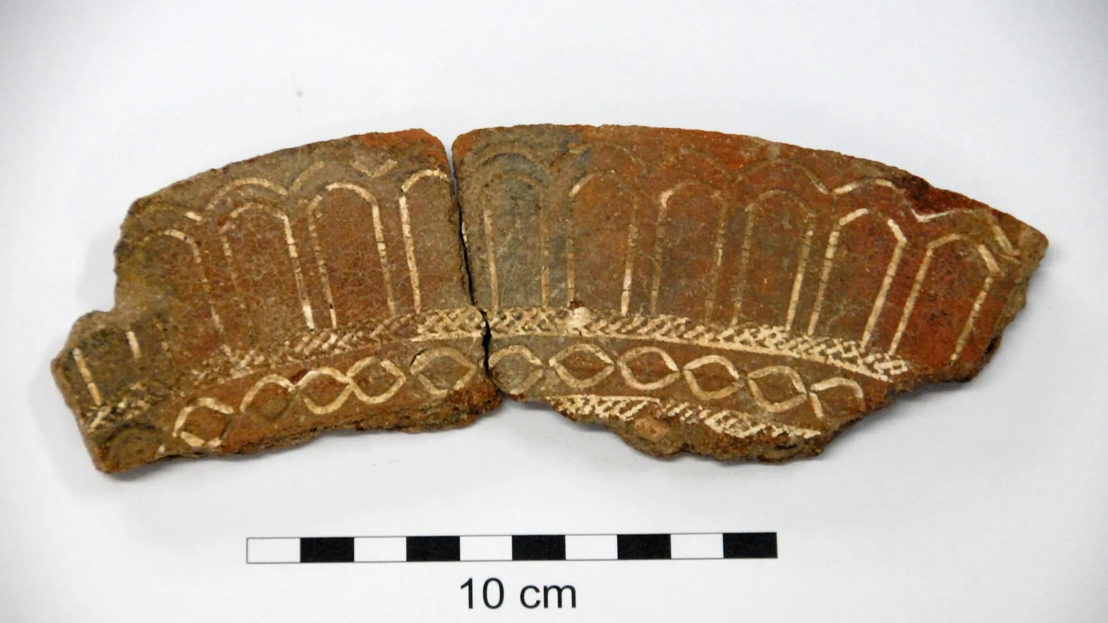
“Level 1 contained Lapita pottery (Sigatoka phase) exposed approximately 2 m above HWST (High Water Spring Tide). Level 2 contained pottery of the applied and relief tradition (cf. Navatu phase) at about 6 m above HWST, and Level 3 had pots of the early historical kuro type at about 8.7 m above HWST.” So Atholl Anderson and seven co-authors, in Geoarchaeology in 2006, summarized the three dark bands that Lawrence Birks traced in 1965 and 1966 along an eroding beach at the mouth of the Sigatoka River, on the south coast of Viti Levu, Fiji, in dunes “among the largest (240 ha) and certainly the highest (53 m above sea level) in tropical Remote Oceania.” Each band was a paleosol, an old ground surface buried by sand. The middle one, Level 2, has drawn the most argument: its soil formed about 2,500 to 2,300 calibrated years before present (cal BP), but the people who left charcoal, potsherds and graves in it lived between 1,700 and 1,300 cal BP.
Quick facts
- When
- 1944 (remains first exposed) · 1965–1966 (Lawrence Birks's excavation) · 1987–1989 (Simon Best's burial excavations) · 1993 (Hurricane Kina) · June 17–28 and July 11–23, 1996 (joint field seasons) · 2006 (optical and radiocarbon dating published) · May 9, 2024 (ten bone dates published)
- Where
- Sigatoka Sand Dunes, site VL 16/1, east of the mouth of the Sigatoka River on the south coast of Viti Levu, Fiji
- Who
- Lawrence Birks; William R. Dickinson; David V. Burley; Atholl Anderson; Simon Best; Yolanda Marshall, Andrew Crosby, Sepeti Matararaba and Sean Wood; Estelle Herrscher; the Fiji Museum
- Outcome
- Three paleosols hold three separate occupations, Lapita (about 2,800–2,600 cal BP), Navatu (charcoal 1,700–1,300 cal BP in a soil that formed about 2,500–2,300 cal BP) and Vuda (600–500 cal BP). Dating published in 2006 kept the three-level model; ten bone dates published in 2024 put the Level 2 burials at 1,888–1,272 cal BP
Birks's trenches, 1965 and 1966
The site, coded VL 16/1, lies about 3 km west of the town of Sigatoka. Estelle Herrscher and four colleagues wrote in PLOS ONE in 2024 that since 1944 the dunes had yielded “potsherd scatters, fireplace scatters, fire-broken rocks, animal and human bone scatters,” earth ovens, postholes and burials under cairns.
William R. Dickinson and seven co-authors, in Asian Perspectives in 1998, called Birks’s dig “by far the most comprehensive” of the projects there and put it at 2,700 square meters; Anderson’s paper says “more than 2600 m2.” Dickinson had seen it, since Birks showed him the site “while his excavated trenches were still open in 1965.” From two charcoal samples Birks placed the lower occupations, in Anderson’s summary, “at about 2650 and 1700 cal yr B.P.” and estimated 1000 BP for Level 3. Later work moved Level 3 to 600 to 500 cal BP. Level 1 stayed put: Anderson’s group gave 2,800 to 2,600 cal BP, and Geoffrey Clark and Anderson gave 2,650 to 2,450 cal BP in Terra Australis 31 in 2009.

Hurricane Kina and the field seasons of 1996
Simon Best dug the graves of Burial Ground 1 in seasons that Herrscher’s paper dates to 1987 and 1988, and a 2017 study by Michael Pietrusewsky, Michele Toomay Douglas and Rona M. Ikehara-Quebral in the Journal of Pacific Archaeology to 1988 and 1989; Andrew Crosby reported further burials to the Fiji Museum in 1991. In Dickinson’s words, “Salvage concerns were amplified in 1993 as a result of damage to the site by Hurricane Kina.” By 1998 Dickinson could describe the dune field as “set aside for perpetuity as Fiji’s first national park,” without giving a year; a table in Timoci Waqaisavou’s 1997 thesis, citing a 1996 report by Cabaniuk, lists the park as established in 1988.
Two teams worked the site in 1996 with the Fiji Museum: Simon Fraser University under David V. Burley from June 17 to 28, and the Australian National University under Anderson from July 11 to 23. The optical dating published in 2006 rests on samples from that work.
Charcoal, bone and sand grains under Level 2
Anderson’s 2006 table lists the Level 2 radiocarbon ages. Birks’s charcoal, GAK 1206, gave 1720±80 BP; charcoal reported by Best in 1989, NZ 7599, gave 1680±60; two of Burley’s samples, CAMS 68194 and CAMS 70921, gave 1620±40 and 1360±30. A human bone reported by Best in 1987, Wk-996b, gave 1870±70, and the authors set it aside: “Leaving aside the age determination on human bone (Wk-996b), a difficult material, the Level 2 radiocarbon (median) ages extend from 1700 to 1300 cal yr B.P.”
The soil was older than its charcoal. Optical dating of sand grains gave 2280±140 years for sample LB155 beneath the paleosol and 2140±150 for LB33 in its lower part, so that “the upper (Level 2) paleosol formed in sediments deposited after 2280±140 yr B.P. (LB155) until at least 2140±150 yr B.P. (LB33).” Anderson’s group matched those centuries to a record of the El Niño-Southern Oscillation (ENSO) that “discloses a substantial period of relatively low activity at 2400–1600 cal yr B.P.”; that quiet period, they wrote, “correlates well with the optically dated deposit in which the Level 2 paleosol formed.” At the eastern end of the dune, later excavation found a Fijian Plainware village dated 1,433 to 1,298 cal BP and, over it, a sea salt works dated 1,330 to 1,266 cal BP, both inside Level 2.
119 burials, three burial grounds
Yolanda Marshall, Andrew Crosby, Sepeti Matararaba and Sean Wood inventoried 119 burials found up to 1998 in their 2000 monograph Sigatoka: The Shifting Sands of Fijian Prehistory. Herrscher’s paper sorts them into three grounds: Burial Ground 3, in Level 3, at least 18 interments in deep pits from the last 500 years; Burial Ground 2, in Level 2, at least 13 burials; and Burial Ground 1, also in Level 2 and 200 m to the east, at least 61 burials, of which Best excavated 55 individuals in 35 graves. Pietrusewsky’s 2017 study examined the health of those skeletons.
Herrscher’s team measured ten AMS radiocarbon dates on bone collagen from Burial Ground 1 and obtained 1,888 to 1,272 cal BP, a span of about 600 years. Burley had tied the cemetery to the Plainware village; the 2024 paper answered that “the contemporaneity between the village and Burial Ground 1 has not been established using radiocarbon determinations” and that the new dates put 70 percent of the burials before the village.
"A simple vertical layercake"
Marshall, Crosby, Matararaba and Wood rejected Dickinson’s 1998 reading as a “reductionist view of the dunes [sic] stratigraphy as a simple vertical layercake” and proposed that the dunes be read “not as a generalized stratigraphic sequence but as complex and variable intercutting and overlapping surfaces.” Anderson’s group answered in 2006 with the dates above: “Recent archaeological research has confirmed the stratigraphic validity of the three-phase model,” and “There is no evidence that occupation of the Sigatoka Dunes occurred continuously.”
The two papers also differ on why the sand moved. Dickinson’s found that “enhanced dune growth began c. 1500 years ago,” caused “chiefly by deforestation as human settlement expanded into the highlands of Viti Levu.” Anderson’s added climate: “human-induced disturbance was assisted significantly by substantial climatic instability during the last millennium.”
The bands Birks traced have stayed three. The newest numbers from the site are Herrscher’s ten bone dates, published on May 9, 2024: 1,888 to 1,272 cal BP, all inside the band Birks called Level 2.
Key facts
- Lawrence Birks excavated the Sigatoka Sand Dunes site (VL 16/1) in 1965 and 1966; Dickinson’s 1998 paper gives 2,700 square meters, Anderson’s 2006 paper “more than 2600 m2.”
- Anderson’s group put the dunes “among the largest (240 ha) and certainly the highest (53 m above sea level) in tropical Remote Oceania” (Geoarchaeology, 2006).
- Level 1 (Lapita) lay about 2 m above high water spring tide, Level 2 (Navatu) about 6 m and Level 3 (kuro pots) about 8.7 m (Anderson, 2006, after Birks 1973).
- Level 1 dates to 2,800–2,600 cal BP (Anderson, 2006; Herrscher, 2024) or 2,650–2,450 cal BP (Clark and Anderson, 2009); Level 3 to 600–500 cal BP.
- Level 2 charcoal dates GAK 1206 (1720±80), NZ 7599 (1680±60), CAMS 68194 (1620±40) and CAMS 70921 (1360±30) give 1,700–1,300 cal BP; bone date Wk-996b (1870±70) was set aside as “a difficult material.”
- Optical dates LB155 (2280±140) and LB33 (2140±150) show the Level 2 paleosol formed centuries before it was occupied; ENSO activity was low at 2,400–1,600 cal BP (Anderson, 2006, citing Moy et al. 2002).
- Marshall, Crosby, Matararaba and Wood inventoried 119 burials up to 1998; Best excavated 55 individuals in 35 graves in Burial Ground 1 (Herrscher, 2024).
- Ten AMS dates on Burial Ground 1 bone collagen span 1,888–1,272 cal BP (PLOS ONE, May 9, 2024); joint field seasons ran June 17–28 and July 11–23, 1996 (Dickinson, 1998).
FAQ
What are Levels 1, 2 and 3 at the Sigatoka Sand Dunes?
Three buried soils, or paleosols, that Lawrence Birks excavated in 1965 and 1966 on the beach face of the dunes. Level 1 holds Lapita pottery, Level 2 pottery of the Navatu style, and Level 3 historical kuro cooking pots, at about 2 m, 6 m and 8.7 m above high water spring tide.
How old is Level 2 at Sigatoka?
Charcoal from Level 2 gives median radiocarbon ages of 1,700 to 1,300 cal BP, in Anderson and colleagues' 2006 tabulation. Optical dating of the sand beneath the paleosol gave 2280±140 years, so the soil formed centuries before anyone cooked or buried their dead on it.
Who dug the Sigatoka burials, and when?
Simon Best excavated 55 individuals in 35 graves in Burial Ground 1 in seasons dated to 1987 and 1988 by Herrscher's 2024 paper and to 1988 and 1989 by Pietrusewsky's 2017 study. Andrew Crosby reported further burials in 1991, and Marshall and colleagues inventoried 119 burials found up to 1998.
Sources
- Anderson, A., Roberts, R., Dickinson, W., Clark, G., Burley, D., de Biran, A., Hope, G., and Nunn, P., "Times of Sand: Sedimentary History and Archaeology at the Sigatoka Dunes, Fiji," Geoarchaeology 21, no. 2 (2006), pp. 131–154; author copy in the Australian National University Open Research Repository.
- Dickinson, W. R., Burley, D. V., Nunn, P. D., Anderson, A., Hope, G., de Biran, A., Burke, C., and Matararaba, S., "Geomorphic and Archaeological Landscapes of the Sigatoka Dune Site, Viti Levu, Fiji: Interdisciplinary Investigations," Asian Perspectives 37, no. 1 (1998), pp. 1–31; University of Hawaii ScholarSpace.
- Herrscher, E., Valentin, F., Zinger, W., Pradier, B., and André, G., "Life histories in Fiji as reconstructed from first millennium CE Sigatoka Sand Dune burials using isotopes," PLOS ONE 19, no. 5 (May 9, 2024), e0300749.
- Pietrusewsky, M., Douglas, M. T., and Ikehara-Quebral, R. M., "Skeletal and Dental Health: the bioarchaeology of the human skeletons from the Sigatoka Sand Dunes Site, VL 16/1, Viti Levu, Fiji," Journal of Pacific Archaeology 8, no. 2 (2017), from p. 53.
- Clark, G., and Anderson, A., "Colonisation and culture change in the early prehistory of Fiji," in Clark and Anderson (eds.), The Early Prehistory of Fiji, Terra Australis 31 (Canberra: ANU E Press, 2009), chapter 16, pp. 407–437.
- Waqaisavou, Timoci, Parks, Reserves and Tourism in Fiji: Native Landowner Attitude and Involvement, MA thesis, Victoria University of Technology, 1997, Tables 5 and 6 (pp. 22–23); Victoria University Institutional Repository.
Cite this article
- APA
- Our Earth's History. (2026, September 22). Three dark bands in a dune: Sigatoka's Levels 1, 2 and 3, dug in 1965. Our Earth's History. https://ourearthshistory.com/oceania/classical/sigatoka-sand-dunes-fiji-level-2-navatu-pottery-birks-1965/
- Chicago
- Our Earth's History. “Three dark bands in a dune: Sigatoka's Levels 1, 2 and 3, dug in 1965.” Our Earth's History, September 22, 2026. https://ourearthshistory.com/oceania/classical/sigatoka-sand-dunes-fiji-level-2-navatu-pottery-birks-1965/.
- MLA
- “Three dark bands in a dune: Sigatoka's Levels 1, 2 and 3, dug in 1965.” Our Earth's History, 22 Sep. 2026, https://ourearthshistory.com/oceania/classical/sigatoka-sand-dunes-fiji-level-2-navatu-pottery-birks-1965/.
Text licensed CC BY-NC-ND 4.0. Found an error? Tell us.