Stone channels for eels at Budj Bim: 6,600 years of Gunditjmara work

TL;DR — DCCEEW dates Gunditjmara eel-channel building at Budj Bim to at least 6,600 years; UNESCO listed Budj Bim in 2019, and a January 2020 fire exposed more channels.
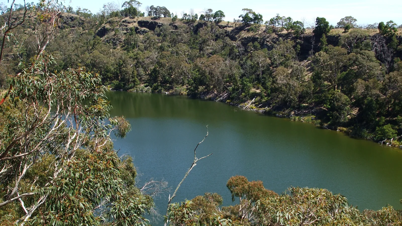
“Over a period of at least 6,600 years the Gunditjmara created, manipulated and modified these local hydrological regimes and ecological systems,” the Australian government’s Department of Climate Change, Energy, the Environment and Water states on its World Heritage page for the Budj Bim Cultural Landscape, in southwestern Victoria. The department credits the Gunditjmara people with using local volcanic rock to build channels, weirs and dams that trapped, stored and harvested kooyang, the short-finned eel, Anguilla australis. The site sits on a lava flow that DCCEEW says erupted more than 30,000 years ago and ran over 50 kilometers toward the sea. It was inscribed on the World Heritage List on July 6, 2019. Ian McNiven of Monash University reports radiocarbon dates showing that one channel at the Muldoons Trap Complex was built at least 6,600 years ago. A fire that burned more than 7,000 hectares over the 2019-2020 summer exposed channels hidden under grass and bracken.
Quick facts
- When
- at least 6,600 years ago (Muldoons Trap Complex channel, dated by Ian McNiven); July 9, 1841 (George Augustus Robinson's record); July 6, 2019 (World Heritage inscription); December 2019 to January 2020 (fire)
- Where
- Budj Bim Cultural Landscape, southwestern Victoria, Australia, comprising the Budj Bim, Kurtonitj and Tyrendarra components; Lake Condah (Tae Rak) and the Muldoons Trap Complex
- Who
- the Gunditjmara people; George Augustus Robinson; Peter Coutts; Harry Lourandos; Heather Builth; Ian McNiven (Monash University); Denis Rose (Gunditj Mirring Traditional Owners Aboriginal Corporation); DCCEEW; Parks Victoria
- Outcome
- the Australian government's Department of Climate Change, Energy, the Environment and Water credits the Gunditjmara with building the channel, weir and dam system over at least 6,600 years; the site was inscribed on the World Heritage List on July 6, 2019, and a fire in the 2019-2020 season exposed channels that had been hidden under vegetation
Channels, weirs and ponds for kooyang
DCCEEW’s Outstanding Universal Value statement describes the method in one line: the Gunditjmara “utilised the abundant local volcanic rock to construct channels, weirs and dams and manage water flows in order to systematically trap, store and harvest kooyang.” The listed property is a serial one of three parts, the department states, “the Budj Bim (northern) component, Kurtonitj (central) component and Tyrendarra (southern) component,” within the boundaries of Budj Bim National Park, the Budj Bim Indigenous Protected Area, the Tyrendarra Indigenous Protected Area and the Lake Condah Mission land. At Tae Rak, the Gunditjmara name for Lake Condah, the department records that traditional water flows were reinstated “through the construction of a cultural weir in 2010, following extensive draining of the lake in the 1950s.” DCCEEW dates Aboriginal occupation of the wider area to “at least 32,000 years,” a span the department calls “deep time.”
1841: a fish-trapping system recorded near Mount William
On July 9, 1841, George Augustus Robinson, the colonial government’s Chief Protector of Aborigines, described finding near Mount William “an immense piece of ground trenched and banked, resembling the work of civilized man but which on inspection I found to be the work of the Aboriginal natives, purposefully constructed for catching eels,” Ian McNiven, a professor of Indigenous archaeology at Monash University, recorded in a 2017 article for The Conversation. Robinson judged the earthworks to run for “some thousands of yards” and to cover “at least 15 acres.” Study lapsed until the 1970s, when Peter Coutts of the Victoria Archaeological Survey mapped “hundreds of metres of excavated channels and dozens of basalt block dam walls” at Lake Condah, moving what McNiven calls “many hundreds of tonnes” of stone; Coutts’s team also recorded C-shaped basalt arrangements three to four meters across, identified as the remains of huts. Heavy rain in 1977 showed how some channels fed natural depressions Coutts called “holding ponds.” Harry Lourandos later traced a further channel at Toolondo, 110 kilometers north, though McNiven notes that “an original construction date for the channel has yet to be determined.” Heather Builth, in the 1990s, built three-dimensional reconstructions of the channels, dams and traps along Darlot Creek and was the first to call the system aquaculture.

Ian McNiven's radiocarbon dates at Muldoons
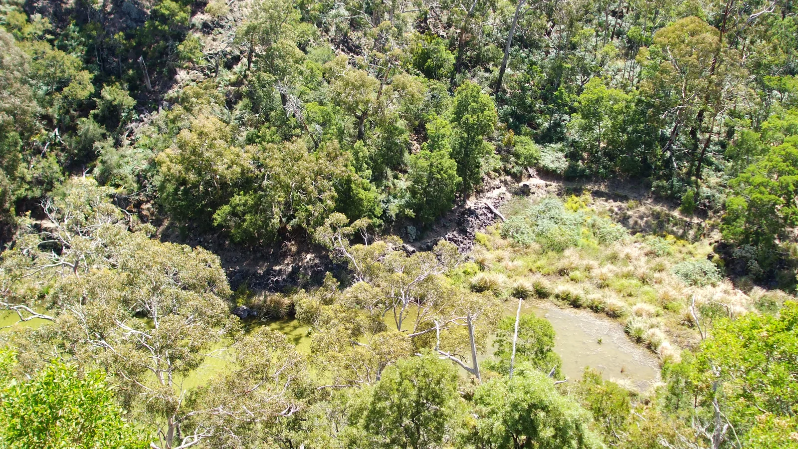
McNiven writes that over the previous decade he and students from Monash University, working with the Gunditjmara, excavated the Muldoons trap system at Lake Condah, which flood sediment had partly buried. “Radiocarbon dating of tiny charcoal fragments within these sediments produced surprising results,” he records. “One channel was built at least 6,600 years ago, while a dam wall was added 500 years ago.” They had found, he writes, “the world’s oldest known stone-walled fish trap . . . also the longest-used fish trap in the world.” Modeling by Tom Richards, part of his doctoral research at Monash, indicated the Muldoons dam ponded water and fish, work McNiven says “provides the earliest available date for Gunditjmara aquaculture.” The Australian National Maritime Museum, citing McNiven’s team, reports that the Muldoons complex “underwent phased redevelopment and major elaboration over the past 800 years” and was “still being used by Gunditjmara people at the Lake Condah Mission in the late 19th century.”
'An Australian Stonehenge': recognition and management
That phrase is the title the Australian National Maritime Museum gave its account of Builth’s research, which estimated that output from the eel farms “would have been enormous — perhaps feeding up to 10,000 people.” DCCEEW records that Budj Bim had already been placed on the National Heritage List on July 20, 2004, before its World Heritage inscription on July 6, 2019, and that in 2007 the Federal Court recognized the Gunditjmara’s “strong and unrelenting connection to this area where their ancestors farmed eels for food and trade, at the time of European settlement and back through millennia.” The museum’s page separately records that a mission at Lake Condah, established in 1868 for Aboriginal survivors of settler violence, closed in 1919; its lands were returned to the Gunditjmara in 1987. DCCEEW names the Gunditj Mirring Traditional Owners Aboriginal Corporation, the Budj Bim Council and the Winda-Mara Aboriginal Corporation as the bodies managing the property under the 2015 Ngootyoong Gunditj, Ngootyoong Mara South West Management Plan; the visitor site budjbim.com.au adds Parks Victoria, naming all three as co-managers.
Seven thousand hectares: the fire of January 2020
Lightning ignited a fire near Lake Condah in late December 2019 that merged with other blazes and, ABC News reported on January 19, 2020, burned more than 7,000 hectares around the lake and in Budj Bim National Park, including parts of the Muldoons trap complex. Denis Rose, project manager for the Gunditj Mirring Traditional Owners Aboriginal Corporation, told the broadcaster that “the fire actually uncovered another smaller system, including a channel about 25 metres in length that we hadn’t noticed before.” He said it “was only maybe 20 metres off the track that we walk in and it was hidden in the long grass and the bracken fern and other vegetation.” Mark Mellington, the far south-west district manager for Forest Fire Management Victoria, said crews avoided heavy machinery in the volcanic, rocky country because, following engagement with the Gunditj Mirring Traditional Owners, “we’d established that there was a significant risk to cultural heritage values in us using machinery.” By January 19, 2020, ABC News reported, a cultural heritage survey with archaeologists and Indigenous rangers, plus aerial photography of the burned ground, was being arranged.
Key facts
- DCCEEW’s World Heritage page states the Gunditjmara built the channel, weir and dam system “over a period of at least 6,600 years.”
- Budj Bim is a serial World Heritage property of three parts: the Budj Bim, Kurtonitj and Tyrendarra components (DCCEEW).
- DCCEEW dates the volcanic eruption that produced Budj Bim’s lava flow to more than 30,000 years ago, with the flow reaching over 50 kilometers toward the sea.
- On July 9, 1841, George Augustus Robinson recorded a Gunditjmara-built eel-trapping earthwork covering “at least 15 acres” near Mount William (quoted by McNiven, 2017).
- Ian McNiven’s team dated one channel at the Muldoons Trap Complex to at least 6,600 years old, with a dam wall added 500 years ago (The Conversation, 2017).
- The Australian National Maritime Museum reports the Muldoons complex was redeveloped over the past 800 years and was still in use at the Lake Condah Mission in the late 19th century.
- Budj Bim was placed on Australia’s National Heritage List on July 20, 2004, and on the World Heritage List on July 6, 2019 (DCCEEW).
- A fire that burned more than 7,000 hectares over the 2019-2020 summer exposed a previously unrecorded 25-meter channel, reported by ABC News on January 19, 2020.
FAQ
How old is the Budj Bim eel-trapping system?
The Australian government's DCCEEW states the Gunditjmara built and modified the channel, weir and dam system "over a period of at least 6,600 years." Ian McNiven's radiocarbon dating attaches that 6,600-year figure specifically to one channel at the Muldoons Trap Complex on Lake Condah; a dam wall there was added 500 years ago.
When did Budj Bim become a World Heritage site?
DCCEEW records Budj Bim's inscription on the World Heritage List on July 6, 2019. It had already been placed on Australia's National Heritage List on July 20, 2004.
What did the 2019-2020 fire reveal at Budj Bim?
ABC News reported on January 19, 2020, that a fire covering more than 7,000 hectares burned through parts of the Muldoons trap complex and exposed a previously unrecorded channel about 25 meters long, described by Gunditj Mirring project manager Denis Rose.
Sources
- Department of Climate Change, Energy, the Environment and Water (DCCEEW), Australian Government, "World Heritage Places: Budj Bim Cultural Landscape" (Internet Archive snapshot, November 24, 2025, of dcceew.gov.au, page last updated May 11, 2022).
- Ian J. McNiven, "The detective work behind the Budj Bim eel traps World Heritage bid," The Conversation, published February 7, 2017.
- Australian National Maritime Museum, "An Australian Stonehenge?"
- Sian Johnson, "Budj Bim Cultural Landscape fire reveals new sections of ancient aquatic system," ABC News, published January 19, 2020.
- Budj Bim Cultural Landscape official visitor site, budjbim.com.au.
- Gunditj Mirring Traditional Owners Aboriginal Corporation, official website, gunditjmirring.com.
- Parks Victoria, "Budj Bim National Park" visitor page.
Cite this article
- APA
- LETTER. (2026, September 28). Stone channels for eels at Budj Bim: 6,600 years of Gunditjmara work. Our Earth's History. https://ourearthshistory.com/oceania/prehistory/budj-bim-gunditjmara-eel-channels-6600-years-2019/
- Chicago
- LETTER. “Stone channels for eels at Budj Bim: 6,600 years of Gunditjmara work.” Our Earth's History, September 28, 2026. https://ourearthshistory.com/oceania/prehistory/budj-bim-gunditjmara-eel-channels-6600-years-2019/.
- MLA
- LETTER. “Stone channels for eels at Budj Bim: 6,600 years of Gunditjmara work.” Our Earth's History, 28 Sep. 2026, https://ourearthshistory.com/oceania/prehistory/budj-bim-gunditjmara-eel-channels-6600-years-2019/.
Text licensed CC BY-NC-ND 4.0. Found an error? Tell us.